
IMAGES TAKEN NEAR TO
Ogwr View, PORTH, CF39 8SF
Introduction
This page details the photographs taken nearby to Ogwr View, CF39 8SF by members of the Geograph project.
The Geograph project started in 2005 with the aim of publishing, organising and preserving representative images for every square kilometre of Great Britain, Ireland and the Isle of Man.

There are currently over 7.5m images from over14,400 individuals and you can help contribute to the project by visiting https://www.geograph.org.uk
Image Map
Images are licensed for reuse under creativecommons.org/licenses/by-sa/2.0
Notes
- Clicking on the map will re-center to the selected point.
- The higher the marker number, the further away the image location is from the centre of the postcode.
Image Listing (65 Images Found)
Images are licensed for reuse under creativecommons.org/licenses/by-sa/2.0
Image
Details
Distance
1

Row of houses at the NW end of High Street, Gilfach Goch
295-281 High Street, nearly 1500 metres from the southern end of High Street in the middle of the village.
Image: © Jaggery
Taken: 11 Apr 2014
0.03 miles
2

Gilfach Goch (left) from Mynydd Pen-y-graig
Mynydd Maes-teg on the right, the road to Evanstown centre
Image: © John Lord
Taken: 20 Sep 2008
0.03 miles
3

New Blandy Terrace houses in Gilfach Goch
Set above the B4564 High Street.
Image: © Jaggery
Taken: 11 Apr 2014
0.03 miles
4
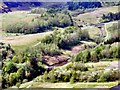
Gilfach Goch Reclaimed
This area was once heavily industrialised with 4 collieries, railway tracks and coal tips.
Image: © Wyndham Jones
Taken: 7 May 2008
0.04 miles
5

Victorian postbox in a house wall, Gilfach Goch
Located at 271 High Street, at the NW end of a long row of houses.
Image: © Jaggery
Taken: 11 Apr 2014
0.05 miles
6
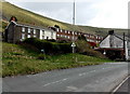
New Blandy Terrace, Gilfach Goch
New Blandy Terrace houses are set above the B4564 High Street.
Image: © Jaggery
Taken: 11 Apr 2014
0.05 miles
7

Houses at the NW end of High Street, Gilfach Goch
Number 301 High Street on the left is at the edge of open countryside,
about 1500 metres from the southern end of High Street in the middle of the village.
Image: © Jaggery
Taken: 11 Apr 2014
0.06 miles
8
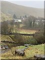
Gilfach Goch
The last houses along the valley at Gilfach Goch.
Image: © Alan Hughes
Taken: 30 Jan 2020
0.06 miles
9
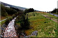
Ogwr Fach flows away from the B4564 in Gilfach Goch
The Ogwr Fach flows south towards its confluence with the Ogwr Fawr at Blackmill.
The combined rivers become the River Ogmore (Afon Ogwr in Welsh).
Image: © Jaggery
Taken: 11 Apr 2014
0.06 miles
10

High Street houses, Gilfach Goch
Viewed across the B4564 High Street. The New Blandy Terrace junction is on the left.
Image: © Jaggery
Taken: 11 Apr 2014
0.06 miles