1
Take a walk or take a rest
Bench and footpath, Llantrisant Rd, Tonyrefail.
Image: © John Lord
Taken: 1 Nov 2017
0.20 miles
2
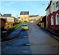
Red Gate Close, Tonyrefail
On the north side of High Street. The Red Gate pub https://www.geograph.org.uk/photo/5649293 is on the right.
Image: © Jaggery
Taken: 10 Jan 2018
0.22 miles
3
Footpath off Collenna Rd, Tonyrefail
Image: © John Lord
Taken: 1 Nov 2017
0.24 miles
4
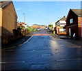
Junction of High Street and Pretoria Road, Tonyrefail
Viewed from the dead-end eastern part of High Street.
The through part of High Street is ahead. Pretoria Road is on the left.
Image: © Jaggery
Taken: 10 Jan 2018
0.24 miles
5
St John's Road, Tonyrefail
Ascending from the north side of High Street. The 30mph speed limit drops to 20 on the approach to a school.
Image: © Jaggery
Taken: 10 Jan 2018
0.24 miles
6
View from Llantrisant Rd, Tonyrefail
Trebanog's houses visible on the skyline.
Image: © John Lord
Taken: 1 Nov 2017
0.24 miles
7
Ordnance Survey Cut Mark
This OS cut mark can be found on No133 High Street. It marks a point 161.892m above mean sea level.
Image: © Adrian Dust
Taken: 27 May 2018
0.24 miles
8
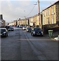
West along High Street, Tonyrefail
Towards the Pretoria Road junction. This is the residential part of High Street - shops are out of shot ahead.
Image: © Jaggery
Taken: 10 Jan 2018
0.24 miles
9
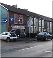
Gwalia Auto Factors, 110 High Street, Tonyrefail
The shop on the corner of The Avenue sells vehicle parts and accessories.
Image: © Jaggery
Taken: 10 Jan 2018
0.24 miles
10
Red Gate in Tonyrefail
High Street pub on the corner of Red Gate Close. https://www.geograph.org.uk/photo/5649317 to the pub sign.
Image: © Jaggery
Taken: 10 Jan 2018
0.25 miles


