1
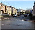
Houses above the eastern end of High Street, Tonyrefail
This is a dead end for motor vehicles. Walkers and cyclists can use the path ahead to reach Llantrisant Road.
Image: © Jaggery
Taken: 10 Jan 2018
0.15 miles
2
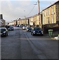
Eastern end of High Street, Tonyrefail
Viewed from the Pretoria Road junction. High Street ahead is a dead end
for motor vehicles, though a sign on the right shows a cycle route ahead.
Image: © Jaggery
Taken: 10 Jan 2018
0.16 miles
3
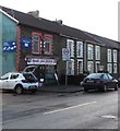
West along High Street, Tonyrefail
Towards the Pretoria Road junction. This is the residential part of High Street - shops are out of shot ahead.
Image: © Jaggery
Taken: 10 Jan 2018
0.18 miles
4
Junction of High Street and Pretoria Road, Tonyrefail
Viewed from the dead-end eastern part of High Street.
The through part of High Street is ahead. Pretoria Road is on the left.
Image: © Jaggery
Taken: 10 Jan 2018
0.18 miles
5
The former Church of St John the Baptist
Now no longer used as a church, having been replaced by St David's when the growing population of Tonyrefail meant it was too small. It subsequently became the HQ of the local Scout troop.
Image: © John Lord
Taken: 1 Nov 2017
0.18 miles
6
Pretoria Road houses, Tonyrefail
Row of houses viewed from the corner of High Street.
Image: © Jaggery
Taken: 10 Jan 2018
0.19 miles
7
Overgrown graveyard and the former Church of St John the Baptist
Image: © John Lord
Taken: 1 Nov 2017
0.19 miles
8
Gwalia Auto Factors, 110 High Street, Tonyrefail
The shop on the corner of The Avenue sells vehicle parts and accessories.
Image: © Jaggery
Taken: 10 Jan 2018
0.19 miles
9
Abandoned and neglected church at Tonyrefail
A noticeboard proclaims this to be the meeting place of a local scout troop though I think that they might well have abandoned it too.
Image: © Mick Lobb
Taken: 19 Sep 2008
0.20 miles
10
Ordnance Survey Cut Mark
This OS cut mark can be found on No133 High Street. It marks a point 161.892m above mean sea level.
Image: © Adrian Dust
Taken: 27 May 2018
0.20 miles


