IMAGES TAKEN NEAR TO
Tonyrefail, PORTH, CF39 8LJ

Introduction

This page details the photographs taken nearby to CF39 8LJ by members of the Geograph project.

The Geograph project started in 2005 with the aim of publishing, organising and preserving representative images for every square kilometre of Great Britain, Ireland and the Isle of Man.

There are currently over 7.5m images from over14,400 individuals and you can help contribute to the project by visiting https://www.geograph.org.uk

Image Map


Images are licensed for reuse under creativecommons.org/licenses/by-sa/2.0
Notes
  • Clicking on the map will re-center to the selected point.
  • The higher the marker number, the further away the image location is from the centre of the postcode.

Image Listing (24 Images Found)

Images are licensed for reuse under creativecommons.org/licenses/by-sa/2.0
  • ...
Image
Details
Distance
1
Feeding Station
Cows at their feeding station at Tylcha Fawr farm.
Image: © Alan Hughes Taken: 9 Mar 2017
0.03 miles
2
St George's Community Day Care Centre, Tonyrefail
Former church
Image: © John Lord Taken: 1 Nov 2017
0.15 miles
3
St.George's Methodist Church
Built as a war memorial in 1925, St.George's closed as a church in 1970 and is now a Day Centre.
Image: © Alan Hughes Taken: 9 Mar 2017
0.15 miles
4
St George's Day Centre, Mill Street, Tonyrefail
The building was originally St George's Church.
Image: © Jaggery Taken: 10 Jan 2018
0.15 miles
5
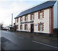
Tonyrefail Police Station in an Edwardian building
Part of the South Wales Police force, viewed across Mill Street. The building is dated 1909.
Image: © Jaggery Taken: 10 Jan 2018
0.15 miles
6
Police Station
Police Station - with Chubb security!
Image: © Alan Hughes Taken: 9 Mar 2017
0.15 miles
7
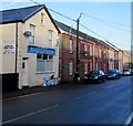
Ely Valley Joinery, Tonyrefail
Viewed across Mill Street.
Image: © Jaggery Taken: 10 Jan 2018
0.16 miles
8
Police Station, Tonyrefail
Image: © John Lord Taken: 1 Nov 2017
0.16 miles
9
Rising Star in Tonyrefail
Rising Star Chinese takeaway is at 96 Mill Street.
Image: © Jaggery Taken: 10 Jan 2018
0.16 miles
10
ACF hut below Mill Street, Tonyrefail
The ACF (Army Cadet Force) hut is a detachment of Dyfed & Glamorgan ACF.
Image: © Jaggery Taken: 10 Jan 2018
0.17 miles
  • ...