
IMAGES TAKEN NEAR TO
Davies Street, PORTH, CF39 0DB
Introduction
This page details the photographs taken nearby to Davies Street, CF39 0DB by members of the Geograph project.
The Geograph project started in 2005 with the aim of publishing, organising and preserving representative images for every square kilometre of Great Britain, Ireland and the Isle of Man.

There are currently over 7.5m images from over14,400 individuals and you can help contribute to the project by visiting https://www.geograph.org.uk
Image Map
Images are licensed for reuse under creativecommons.org/licenses/by-sa/2.0
Notes
- Clicking on the map will re-center to the selected point.
- The higher the marker number, the further away the image location is from the centre of the postcode.
Image Listing (64 Images Found)
Images are licensed for reuse under creativecommons.org/licenses/by-sa/2.0
Image
Details
Distance
1
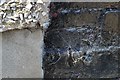
Ordnance Survey Cut Mark
This OS cut mark can be found on No1 Penmain Street. It marks a point 138.273m above mean sea level.
Image: © Adrian Dust
Taken: 24 Jun 2017
0.07 miles
2
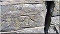
Ordnance Survey Cut Mark
This OS cut mark can be found on the wall north side of Cemetery Road. It marks a point 107.637m above mean sea level.
Image: © Adrian Dust
Taken: 24 Jun 2017
0.08 miles
3
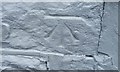
Ordnance Survey Cut Mark
This OS cut mark can be found on the gatepost of No37 Troedyrhiw Road. It marks a point 118.319m above mean sea level.
Image: © Adrian Dust
Taken: 24 Jun 2017
0.08 miles
4
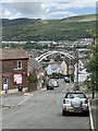
Troedyrhiw Road, Porth
View downhill towards Porth and the bridge over the Rhondda rivers.
Image: © Alan Hughes
Taken: 6 Jul 2020
0.08 miles
5
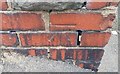
Ordnance Survey Cut Mark
This OS cut mark can be found on the wall at the junction of Troedyrhiw and Turberville Roads. It marks a point 137.319m above mean sea level.
Image: © Adrian Dust
Taken: 24 Jun 2017
0.09 miles
6
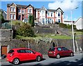
Houses above Aberrhondda Road, Porth
These four semi-detached houses are set back 15 metres from,
and several metres above, the west side of Aberrhondda Road.
Image: © Jaggery
Taken: 19 Sep 2012
0.10 miles
7
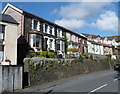
Aberrhondda Road houses, Porth
These houses on the west side of Aberrhondda Road are set about 2 metres above road level.
Image: © Jaggery
Taken: 19 Sep 2012
0.11 miles
8
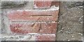
Ordnance Survey Cut Mark
This OS cut mark can be found on the garage of No2 Troedyrhiw Road. It marks a point 112.624m above mean sea level.
Image: © Adrian Dust
Taken: 24 Jun 2017
0.11 miles
9
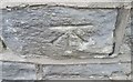
Ordnance Survey Cut Mark
This OS cut mark can be found on No3 Troedyrhiw Road. It marks a point 150.285m above mean sea level.
Image: © Adrian Dust
Taken: 24 Jun 2017
0.11 miles
10
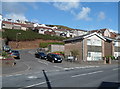
Packers Road, Porth
A shadow points across Aberrhondda Road towards Packers Road which leads to Aldergrove Road.
Image: © Jaggery
Taken: 19 Sep 2012
0.11 miles