
IMAGES TAKEN NEAR TO
Mount Pleasant, PORTH, CF39 0BG
Introduction
This page details the photographs taken nearby to CF39 0BG by members of the Geograph project.
The Geograph project started in 2005 with the aim of publishing, organising and preserving representative images for every square kilometre of Great Britain, Ireland and the Isle of Man.

There are currently over 7.5m images from over14,400 individuals and you can help contribute to the project by visiting https://www.geograph.org.uk
Image Map
Images are licensed for reuse under creativecommons.org/licenses/by-sa/2.0
Notes
- Clicking on the map will re-center to the selected point.
- The higher the marker number, the further away the image location is from the centre of the postcode.
Image Listing (26 Images Found)
Images are licensed for reuse under creativecommons.org/licenses/by-sa/2.0
Image
Details
Distance
1
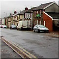
Cemetery Road houses and vehicles, Porth
On the south side of the B4278 Cemetery Road in the west of Porth.
Image: © Jaggery
Taken: 10 Oct 2017
0.11 miles
2
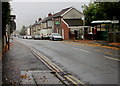
From Trealaw to Porth
From the eastern edge of Trealaw, the B4278 Cemetery Road passes the Porth boundary signs.
Image: © Jaggery
Taken: 10 Oct 2017
0.11 miles
3
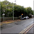
Trealaw boundary sign
The sign alongside the B4278 Cemetery Road is at the eastern edge of Trealaw,
facing the western edge of Porth. The yellow back of a speed camera is near the cars.
Image: © Jaggery
Taken: 10 Oct 2017
0.11 miles
4
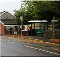
Cemetery Road bus stop and shelter, Porth
This stop is for buses to Tonypandy and beyond. Viewed from Trealaw past a Porth boundary sign.
Image: © Jaggery
Taken: 10 Oct 2017
0.12 miles
5
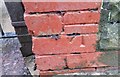
Ordnance Survey Cut Mark
This OS cut mark can be found on No38 Cemetery Road. It marks a point 134.255m above mean sea level.
Image: © Adrian Dust
Taken: 27 May 2018
0.12 miles
6
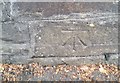
Ordnance Survey Cut Mark
This OS cut mark can be found on the cemetery wall. It marks a point 142.893m above mean sea level.
Image: © Adrian Dust
Taken: 27 May 2018
0.13 miles
7
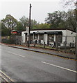
Griffith Memorials, Trealaw
Monumental masons premises alongside the B4278 Cemetery Road opposite Trealaw Cemetery.
Image: © Jaggery
Taken: 10 Oct 2017
0.14 miles
8
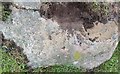
Ordnance Survey Rivet
This damaged OS rivet (rivet missing) can be found on a rock NE side of the track. It marks a point 194.715m above mean sea level.
Image: © Adrian Dust
Taken: 24 Jun 2017
0.14 miles
9
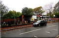
Cemetery Road monumental masons, Trealaw
Griffith Memorials located opposite Trealaw Cemetery.
Image: © Jaggery
Taken: 10 Oct 2017
0.14 miles
10
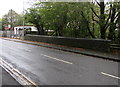
Stone wall on the south side of Cemetery Road, Trealaw
The wall is at the edge of the bridge carrying the B4278 Cemetery Road
over an unnamed brook, a small tributary of the Rhondda River.
Image: © Jaggery
Taken: 10 Oct 2017
0.14 miles