IMAGES TAKEN NEAR TO
Gelynog Court, PONTYPRIDD, CF38 2RJ

Introduction

This page details the photographs taken nearby to Gelynog Court, CF38 2RJ by members of the Geograph project.

The Geograph project started in 2005 with the aim of publishing, organising and preserving representative images for every square kilometre of Great Britain, Ireland and the Isle of Man.

There are currently over 7.5m images from over14,400 individuals and you can help contribute to the project by visiting https://www.geograph.org.uk

Image Map


Images are licensed for reuse under creativecommons.org/licenses/by-sa/2.0
Notes
  • Clicking on the map will re-center to the selected point.
  • The higher the marker number, the further away the image location is from the centre of the postcode.

Image Listing (6 Images Found)

Images are licensed for reuse under creativecommons.org/licenses/by-sa/2.0
Image
Details
Distance
1
From 20 to 30, Penycoedcae Road, Beddau
The 20mph speed limit in force near a school increases to 30mph.
Image: © Jaggery Taken: 30 Mar 2018
0.20 miles
2
Mini-roundabout at the northern edge of Beddau
At the junction of Penycoedcae Road and Heol-y-Beddau (ahead).
Image: © Jaggery Taken: 30 Mar 2018
0.21 miles
3
Junction of Penycoedcae Road and Heol-y-Beddau Road, Beddau
Penycoedcae Road is on the camera side and ahead on the left. Heol-y-Beddau Road is on the right. The 20mph speed limit in force past Bryn Celynnog Comprehensive School increases to 30mph beyond the mini-roundabout.
Image: © Jaggery Taken: 30 Mar 2018
0.21 miles
4
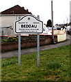
Welcome to/Croeso i/ Beddau
Located here https://www.geograph.org.uk/photo/5721439 at the northern edge of the village in the county borough of Rhondda Cynon Taf, about 3km from Llantrisant and 7km from Pontypridd. The local pronunciation of the village name by English speakers is similar to Bather. The literal meaning of the Welsh Beddau is Graves or Tombs. The reason for the name is obscure - one possibility is that this area was an ancient (pre-Christian) burial site.
Image: © Jaggery Taken: 30 Mar 2018
0.22 miles
5
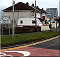
Directions sign at the northern edge of Beddau
Alongside Penycoedcae Road a few metres from the Welcome to/Croeso i Beddau sign https://www.geograph.org.uk/photo/5721466 on the left.
Image: © Jaggery Taken: 30 Mar 2018
0.23 miles
6
Exit from Bryn Celynnog Comprehensive School, Beddau
Into Penycoedcae Road.
Image: © Jaggery Taken: 30 Mar 2018
0.25 miles