1
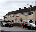
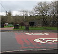
Fairview, Tynant
Fairview leads to Forest Road in the Gwaunmiskin area of Beddau.
Image: © Jaggery
Taken: 7 Apr 2018
0.03 miles
2
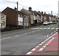
On-street parking, Fairview, Tynant
Cars are parked alongside a row of houses in Fairview, a road on the south side of the B4595.
Image: © Jaggery
Taken: 7 Apr 2018
0.06 miles
3
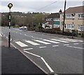
Zebra crossing, Parish Road, Tynant
Across the B4595 here named Parish Road. The car is on the corner of Fairview.
Image: © Jaggery
Taken: 7 Apr 2018
0.09 miles
4
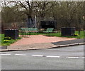
Codgers Corner, Tynant
This corner of Fairview and Parish Road is shown on maps as Codgers Corner.
An old colliery dram https://www.geograph.org.uk/photo/6397549 is in the background.
Image: © Jaggery
Taken: 7 Apr 2018
0.09 miles
5
Plaque on a former colliery dram, Codgers Corner, Tynant
Located here. https://www.geograph.org.uk/photo/6397549
Image: © Jaggery
Taken: 7 Apr 2018
0.09 miles
6
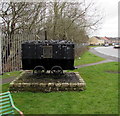
Old colliery dram, Codgers Corner, Tynant
The plaque https://www.geograph.org.uk/photo/6397558 on the dram records it was erected by Llantrisant Community Council and officially unveiled by the chairman on April 15th 1995 in recognition of the people who worked at Cwm Colliery (1909-1987).
This corner of Fairview and Parish Road is shown on maps as Codgers Corner.
Image: © Jaggery
Taken: 7 Apr 2018
0.09 miles
7
From 30 to 20, Fairview, Tynant
The 30mph speed limit on the B4595 Parish Road drops to 20mph along Fairview.
Image: © Jaggery
Taken: 7 Apr 2018
0.09 miles
8
From 20 to 30, Fairview, Tynant
The 20mph speed limit on the road named Fairview increases to 30mph
on the approach to the B4595 Parish Road. Codgers Corner https://www.geograph.org.uk/photo/6397568 is in the background.
Image: © Jaggery
Taken: 7 Apr 2018
0.09 miles
9
Ascent from Tynant towards Beddau
The B4595 Parish Road in Tynant ascends towards Beddau. The red surface of Commercial Street is on the right.
Image: © Jaggery
Taken: 7 Apr 2018
0.09 miles
10
Telecoms cabinet on a Tynant corner
The dark green cabinet is on the corner of Fairview and the B4595 Parish Road.
Image: © Jaggery
Taken: 7 Apr 2018
0.09 miles


