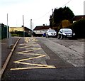
1
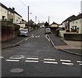
North along Castell-y-Mynach Road, Beddau
From Llwyncrwn Road.
Image: © Jaggery
Taken: 30 Mar 2018
0.01 miles
2
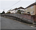
Green Space
Green space in front of housing at Beddau. There is a symmetrical design opposite.
Image: © Alan Hughes
Taken: 9 Mar 2017
0.03 miles
3
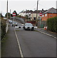
Llwyncrwn Road speed bumps, Beddau
On the approach to a primary school entrance. https://www.geograph.org.uk/photo/5723403
Image: © Jaggery
Taken: 30 Mar 2018
0.05 miles
4
Elevated pavement on the north side of Llwyncrwn Road, Beddau
In the background here. https://www.geograph.org.uk/photo/5722099
Image: © Jaggery
Taken: 30 Mar 2018
0.05 miles
5
Metal barrier across Llwyncrwn Road, Beddau
The barrier makes the No Entry signs superfluous, which suggests
that the barrier was installed after the signs proved to be ineffectual.
Image: © Jaggery
Taken: 30 Mar 2018
0.05 miles
6
Road Barrier
Road in the vicinity of Llwyncrwn School permanently closed.
Image: © Alan Hughes
Taken: 9 Mar 2017
0.06 miles
7
Dead-end northern arm of Llwyncrwn Road, Beddau
Viewed from the main part of Llwyncrwn Road.
Image: © Jaggery
Taken: 30 Mar 2018
0.06 miles
8
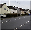
Llantrisant Road houses, Beddau
On the west side of the B4595 Llantrisant Road.
Image: © Jaggery
Taken: 30 Mar 2018
0.06 miles
9
Zigzag yellow markings on Llwyncrwn Road, Beddau
Marking the Keep Clear Zone (no stopping or parking) near the entrance https://www.geograph.org.uk/photo/5723403 to Llwyncrwn Primary School.
Image: © Jaggery
Taken: 30 Mar 2018
0.07 miles
10
Western Power Distribution electricity substation at the edge of a churchyard, Beddau
In the NW corner of St Michael & All Angels churchyard, on the south side of Llwyncrwn Road.
The substation identifier is BEDDAU RMU No 2 S/S 54-2754.
Image: © Jaggery
Taken: 30 Mar 2018
0.07 miles


