IMAGES TAKEN NEAR TO
Alexon Way, PONTYPRIDD, CF37 5BS

Introduction

This page details the photographs taken nearby to Alexon Way, CF37 5BS by members of the Geograph project.

The Geograph project started in 2005 with the aim of publishing, organising and preserving representative images for every square kilometre of Great Britain, Ireland and the Isle of Man.

There are currently over 7.5m images from over14,400 individuals and you can help contribute to the project by visiting https://www.geograph.org.uk

Image Map


Images are licensed for reuse under creativecommons.org/licenses/by-sa/2.0
Notes
  • Clicking on the map will re-center to the selected point.
  • The higher the marker number, the further away the image location is from the centre of the postcode.

Image Listing (45 Images Found)

Images are licensed for reuse under creativecommons.org/licenses/by-sa/2.0
  • ...
Image
Details
Distance
1
Watery construction site in Hawthorn
Viewed from Cardiff Road in mid February 2014. Clouds reflect off a large puddle in the site on which houses are to be built as part of the Charles Church Alexander Place development. This is a brownfield site, formerly Alexon House occupied by M.E.A.D Manufacturing.
Image: © Jaggery Taken: 13 Feb 2014
0.02 miles
2
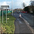
Hawthorn boundary sign
Viewed along Cardiff Road from Rhydyfelin. Hawthorn is a village in the SE of the County Borough of Rhondda Cynon Taf, about 10 miles NW of Cardiff.
Image: © Jaggery Taken: 13 Feb 2014
0.08 miles
3
Spencer Place, Hawthorn
Viewed across Cardiff Road looking towards the corner of Spencer Lane.
Image: © Jaggery Taken: 13 Feb 2014
0.08 miles
4
Lon Heulog, Hawthorn
Lon Heulog is a 70 metre long cul-de-sac on the east side of Fairfield Lane.
Image: © Jaggery Taken: 13 Feb 2014
0.09 miles
5
Rhydyfelin boundary sign
Viewed along Cardiff Road from Hawthorn. Rhydyfelin is a village in the SE of the County Borough of Rhondda Cynon Taf.
Image: © Jaggery Taken: 13 Feb 2014
0.09 miles
6
Corrugated metal sports pavilion, Hawthorn
Viewed over a perimeter fence from the northern end of Fairfield Close. http://www.geograph.org.uk/photo/3847203
Image: © Jaggery Taken: 13 Feb 2014
0.10 miles
7
Rhydyfelin Football Club pitch
Viewed across the fence on the Fairfield Lane, Hawthorn side looking towards flats in Glanfelin in the village of Rhydyfelin.
Image: © Jaggery Taken: 13 Feb 2014
0.10 miles
8
Glanfelin flats in Rhydyfelin
Viewed across Cardiff Road.
Image: © Jaggery Taken: 13 Feb 2014
0.11 miles
9
Fairfield Close, Hawthorn
Fairfield Close is an 80 metre long cul-de-sac on the north side of Cardiff Road. The far end of the close is at the perimeter fence of a sports ground.
Image: © Jaggery Taken: 13 Feb 2014
0.11 miles
10
Hawthorn Ambulance Station
Viewed across Cardiff Road. The station is on the corner of St Luke's Avenue.
Image: © Jaggery Taken: 13 Feb 2014
0.12 miles
  • ...