1
Hawthorn Ambulance Station
Viewed across Cardiff Road. The station is on the corner of St Luke's Avenue.
Image: © Jaggery
Taken: 13 Feb 2014
0.05 miles
2
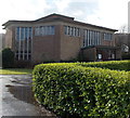
Church of St Luke, Rhydyfelin
Viewed from Cardiff Road. The church is in the Church in Wales Parish of Rhydyfelin, Diocese of Llandaff.
Image: © Jaggery
Taken: 13 Feb 2014
0.06 miles
3
Rhydyfelin boundary sign
Viewed along Cardiff Road from Hawthorn. Rhydyfelin is a village in the SE of the County Borough of Rhondda Cynon Taf.
Image: © Jaggery
Taken: 13 Feb 2014
0.06 miles
4
Rhydyfelin War Memorial
On the south side of Cardiff Road, at the edge of St Luke's church. http://www.geograph.org.uk/photo/3847082
Image: © Jaggery
Taken: 13 Feb 2014
0.06 miles
5
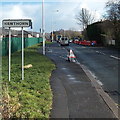
Hawthorn boundary sign
Viewed along Cardiff Road from Rhydyfelin. Hawthorn is a village in the SE of the County Borough of Rhondda Cynon Taf, about 10 miles NW of Cardiff.
Image: © Jaggery
Taken: 13 Feb 2014
0.07 miles
6
Glanfelin flats in Rhydyfelin
Viewed across Cardiff Road.
Image: © Jaggery
Taken: 13 Feb 2014
0.08 miles
7
West side of Nant-y-dall Avenue, Rhydyfelin
Viewed from Cardiff Road.
Image: © Jaggery
Taken: 13 Feb 2014
0.08 miles
8
Rhydyfelin Football Club pitch
Viewed across the fence on the Fairfield Lane, Hawthorn side
looking towards flats in Glanfelin in the village of Rhydyfelin.
Image: © Jaggery
Taken: 13 Feb 2014
0.10 miles
9
Watery construction site in Hawthorn
Viewed from Cardiff Road in mid February 2014. Clouds reflect off a large puddle in the site on which houses are to be built as part of the Charles Church Alexander Place development. This is a brownfield site, formerly Alexon House occupied by M.E.A.D Manufacturing.
Image: © Jaggery
Taken: 13 Feb 2014
0.12 miles
10
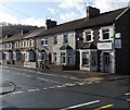
De Barri Street, Rhydyfelin
Viewed from Cardiff Road. The corner shop, Rhydyfelin Convenience Store, was closed early afternoon on a weekday...
Image: © Jaggery
Taken: 13 Feb 2014
0.13 miles


