1
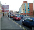
Oldway House, Broadway, Pontypridd
Located on the north side of the A4058 Broadway, the UK government office building contains Pontypridd Jobcentre Plus.
Image: © Jaggery
Taken: 8 Mar 2019
0.01 miles
2
Wall between railway and road, Pontypridd
An attempt has been made to make this wall more attractive, with textured panels and some relief sculpture.
Image: © David Smith
Taken: 21 Sep 2022
0.02 miles
3
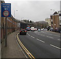
Low bridge sign alongside Broadway, Pontypridd
This bridge https://www.geograph.org.uk/photo/6084852 is near the left turn ahead. Pont isel is Welsh for Low bridge.
Image: © Jaggery
Taken: 8 Mar 2019
0.02 miles
4
Disused platform, Pontypridd railway station
Pontypridd railway station at the January 2012 date of this view was much reduced from its former glory. At one time, it had the longest railway platform in the world, able to accommodate two full-length trains on each side of the island platform, as well as additional trains in bay platforms.
This platform appears long disused, judging by the grass and weeds growing where once was a railway track. On the other side of the wall is platform 1, only a small part of which is still in use. http://www.geograph.org.uk/photo/3208306
Image: © Jaggery
Taken: 12 Jan 2012
0.03 miles
5
Rhondda Cynon Taf twinning information in Pontypridd
The sign alongside the A4058 Broadway shows that Rhondda Cynon Taf county borough is twinned with Wolfenbüttel, Nürtingen & Ravensburg (all in Germany) and Montélimar in France.
Image: © Jaggery
Taken: 8 Mar 2019
0.03 miles
6
Kwik Fit Pontypridd
On the north side of the A4058 near Pontypridd railway station.
Image: © Jaggery
Taken: 8 Mar 2019
0.04 miles
7
High wall on the south side of Broadway, Pontypridd
On the approach to Pontypridd railway station.
Image: © Jaggery
Taken: 8 Mar 2019
0.04 miles
8
Oldway House, Pontypridd
Near its western end, Broadway passes a Pontypridd Town Centre sign.
The building on the right, Oldway House, contains a Job Centre Plus.
Ahead on the left is Pontypridd railway station.
Image: © Jaggery
Taken: 9 Dec 2011
0.04 miles
9
Platform 1, Pontypridd railway station
A train is waiting at the SE end of platform 1, the only part of the platform still in use.
At about 225 metres, platform 1 is far longer than the trains that now stop here
(usually 2, 3 or 4 carriages). Therefore, most of the platform is now not used.
The track alongside the unused part has been removed. http://www.geograph.org.uk/photo/3208306
Image: © Jaggery
Taken: 12 Jan 2012
0.04 miles
10
Relief sculpture, wall between road and railway, Pontypridd
Image: © David Smith
Taken: 21 Sep 2022
0.04 miles


