
IMAGES TAKEN NEAR TO
South Street, PONTYPRIDD, CF37 4PR
Introduction
This page details the photographs taken nearby to South Street, CF37 4PR by members of the Geograph project.
The Geograph project started in 2005 with the aim of publishing, organising and preserving representative images for every square kilometre of Great Britain, Ireland and the Isle of Man.

There are currently over 7.5m images from over14,400 individuals and you can help contribute to the project by visiting https://www.geograph.org.uk
Image Map
Images are licensed for reuse under creativecommons.org/licenses/by-sa/2.0
Notes
- Clicking on the map will re-center to the selected point.
- The higher the marker number, the further away the image location is from the centre of the postcode.
Image Listing (141 Images Found)
Images are licensed for reuse under creativecommons.org/licenses/by-sa/2.0
Image
Details
Distance
1
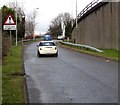
Cattle grid warning sign alongside an A470 slip road in Pontypridd
A car approaches a cattle grid across the slip road from Bridge Street to the A470.
Image: © Jaggery
Taken: 8 Mar 2015
0.02 miles
2
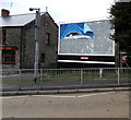
Not much of a prime sight in Pontypridd
In early March 2015, only a fragment of an advert remains on the Primesight hoarding at the edge of the Llanover Arms pub. http://www.geograph.org.uk/photo/4375768
Image: © Jaggery
Taken: 8 Mar 2015
0.04 miles
3
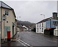
West Street, Pontypridd
Looking north along West Street towards South Street.
The pillar box is at the edge of Sheppards Pharmacy. http://www.geograph.org.uk/photo/4375873
Image: © Jaggery
Taken: 8 Mar 2015
0.04 miles
4
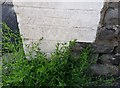
Ordnance Survey Cut Mark
This OS cut mark can be found on No6 North Street. It marks a point 65.352m above mean sea level.
Image: © Adrian Dust
Taken: 6 Jul 2018
0.04 miles
6
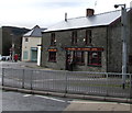
The Llanover Arms, Pontypridd
One of the oldest buildings in Pontypridd, the Bridge Street pub was built c1780 on land owned by Lady Llanover. During the 19th century it prospered because of its location next to the Glamorganshire Canal.
Image: © Jaggery
Taken: 8 Mar 2015
0.05 miles
7
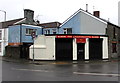
The Launderette, Pontypridd
On the corner of Bridge Street and West Street. The Llanover Arms http://www.geograph.org.uk/photo/4375768 is on the right.
Image: © Jaggery
Taken: 8 Mar 2015
0.05 miles
8
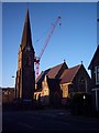
St Catherine's Church
The Church (before the new building is complete)
Image: © Graham Masters
Taken: 8 Mar 2007
0.05 miles
9
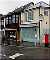
Sheppards Pharmacy in Bridge Street, Pontypridd
Viewed in March 2015. This corner shop used to be Stryd y Bont post office. http://www.geograph.org.uk/photo/1828139
Image: © Jaggery
Taken: 8 Mar 2015
0.06 miles
10
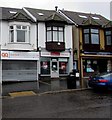
Quick Quote in Pontypridd
Quick Quote Insurance Services office on the left is at 14 Bridge Street.
Also in view are Motaquote and Park View Cafe.
Image: © Jaggery
Taken: 8 Mar 2015
0.06 miles