1
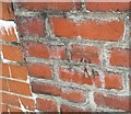
Ordnance Survey Cut Mark
This OS cut mark can be found on the garage west side of Tygwyn Road. It marks a point 122.936m above mean sea level.
Image: © Adrian Dust
Taken: 6 Jul 2018
0.13 miles
2
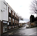
NE along Merthyr Road, Pontypridd
Looking northeastwards from the corner of Common Road. The red postbox http://www.geograph.org.uk/photo/4377649 in the wall is Edwardian.
Image: © Jaggery
Taken: 8 Mar 2015
0.15 miles
3
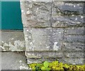
Ordnance Survey Cut Mark
This OS cut mark can be found on Welsh Water's Point 9 Blockhouse. It marks a point 148.221m above mean sea level.
Image: © Adrian Dust
Taken: 4 May 2024
0.15 miles
4
Llanover Road, Pontypridd
Llanover House http://www.geograph.org.uk/photo/4377578 is on the left.
Image: © Jaggery
Taken: 8 Mar 2015
0.19 miles
5
Path from school to footbridge, Pontypridd
From Coedpenmaen Primary School to this footbridge http://www.geograph.org.uk/photo/4377441 over the A470.
Image: © Jaggery
Taken: 8 Mar 2015
0.19 miles
6
Footbridge over A470, Pontypridd
The bridge leads to (on the right) Coedpenaen Primary School
Image: © David Smith
Taken: 17 Sep 2022
0.19 miles
7
Footbridge over the A470 near Coedpenmaen Primary School, Pontypridd
Viewed from the Coedpenmaen Close path past the edge of this http://www.geograph.org.uk/photo/4377430 school.
The far side of the bridge is in Coedpenmaen Road.
Image: © Jaggery
Taken: 8 Mar 2015
0.19 miles
8
Coedpenmaen Primary School, Pontypridd
Viewed from the path past the school at the northern end of Coedpenmaen Close, on the east side of the A470.
Image: © Jaggery
Taken: 8 Mar 2015
0.19 miles
9
Footbridge over A470 at Trallyn
Image: © John Firth
Taken: 7 Sep 2012
0.20 miles
10
Footbridge within Trallwn over A470
A footbridge connected housing estates within Trallwn, providing a link avoiding long walks to the underpass or roundabout.
Image: © David Smith
Taken: 7 Jul 2011
0.20 miles


