IMAGES TAKEN NEAR TO
Augustus Street, PONTYPRIDD, CF37 3LH

Introduction

This page details the photographs taken nearby to Augustus Street, CF37 3LH by members of the Geograph project.

The Geograph project started in 2005 with the aim of publishing, organising and preserving representative images for every square kilometre of Great Britain, Ireland and the Isle of Man.

There are currently over 7.5m images from over14,400 individuals and you can help contribute to the project by visiting https://www.geograph.org.uk

Image Map


Images are licensed for reuse under creativecommons.org/licenses/by-sa/2.0
Notes
  • Clicking on the map will re-center to the selected point.
  • The higher the marker number, the further away the image location is from the centre of the postcode.

Image Listing (70 Images Found)

Images are licensed for reuse under creativecommons.org/licenses/by-sa/2.0
  • ...
Image
Details
Distance
1
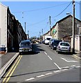
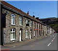
Augustus Street, Ynysybwl
The south side of the street, from the Windsor Place end.
Image: © Jaggery Taken: 16 Apr 2015
0.01 miles
2
High Street, Ynysybwl
High in the sense of steep, perhaps. There are no shops in this High Street.
Image: © Jaggery Taken: 16 Apr 2015
0.04 miles
3
Ynysybwl Community Centre
In the centre of the village, on the SW side of the War Memorial. http://www.geograph.org.uk/photo/4433091
Image: © Jaggery Taken: 16 Apr 2015
0.04 miles
4
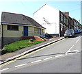
Former Ynysybwl police station
Viewed in April 2015. The Police Station name board seen in a September 2009 Google Earth Street View has gone from the single storey building at the eastern end of Paget Street.
Image: © Jaggery Taken: 16 Apr 2015
0.05 miles
5
High Street speed bumps, Ynysybwl
The speed limit here is 20mph.
Image: © Jaggery Taken: 16 Apr 2015
0.05 miles
6
Paget Street, Ynysybwl
Looking westwards across Penygraig Terrace.
Image: © Jaggery Taken: 16 Apr 2015
0.05 miles
7
Ordnance Survey Cut Mark
This OS cut mark can be found on No1 Crawshay Street. It marks a point 146.403m above mean sea level.
Image: © Adrian Dust Taken: 1 Mar 2021
0.05 miles
8
North side of High Street, Ynysybwl
There are no shops in this High Street.
Image: © Jaggery Taken: 16 Apr 2015
0.05 miles
9
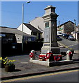
Ynysybwl Cenotaph War Memorial
Located in the centre of the village, between Windsor Place and Penygraig Terrace. Cenotaph is derived from the Greek for empty tomb.
Image: © Jaggery Taken: 16 Apr 2015
0.05 miles
10
Ynysybwl Constitutional Club
On the corner of Windsor Place and Penygraig Terrace.
Image: © Jaggery Taken: 16 Apr 2015
0.05 miles
  • ...