1
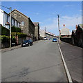
Towards a slightly raised pavement in Ynysybwl
Alongside the B4273 Clydach Road.
Image: © Jaggery
Taken: 16 Apr 2015
0.08 miles
2
Nant Clydach, Ynysybwl
Stream viewed from the B4273 Clydach Road.
Image: © Jaggery
Taken: 16 Apr 2015
0.08 miles
3
End of the elevated pavement, Clydach Road, Ynysybwl
The slightly elevated pavement is between the B4273 Clydach Road and a stream, Nant Clydach.
Image: © Jaggery
Taken: 16 Apr 2015
0.08 miles
4
Other Street houses, Ynysybwl
Part of a long dead-end street connecting with the B4273 60 metres behind the camera.
According to one source, this is the only Other Street in the UK. I do not know the origin of the name.
Image: © Jaggery
Taken: 16 Apr 2015
0.09 miles
5
Up Other Street, Ynysybwl
Other Street is a long dead-end street on the north side of the B4273.
According to one source, this is the only Other Street in the UK.
Tabernacle Independent Chapel http://www.geograph.org.uk/photo/4432909 is on the left.
Image: © Jaggery
Taken: 16 Apr 2015
0.10 miles
6
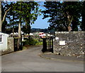
Entrance to Ynysybwl Cemetery
From Heol-y-Plwyf.
Image: © Jaggery
Taken: 16 Apr 2015
0.11 miles
7
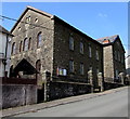
Tabernacle Independent Chapel, Ynysybwl
Viewed across Other Street. The nameboard on the wall in April 2015 shows the Welsh language spelling Tabernacl. The chapel was built in the 1880s at the north end of the newer part of Ynysybwl.
The Sunday School extension on the right side was added in the first decade of the 20th century. This part of the chapel is now used as an Ynysybwl Foodbank distribution point, run in co-operation with all the other chapels and churches in Ynysybwl.
Image: © Jaggery
Taken: 16 Apr 2015
0.12 miles
8
Barrier at the edge of Clydach Road, Ynysybwl
At the edge of a stream, Nant Clydach.
Image: © Jaggery
Taken: 16 Apr 2015
0.12 miles
9
Y Waun, Ynysybwl
Cul-de-sac near Ynysybwl Cemetery.
Image: © Jaggery
Taken: 16 Apr 2015
0.13 miles
10
Tabernacle Welsh Independent Chapel
Chapel in the strangely named ‘Other Street’, Ynysybwl.
Image: © Alan Hughes
Taken: 1 Feb 2021
0.13 miles


