IMAGES TAKEN NEAR TO
Y Waun, PONTYPRIDD, CF37 3HZ

Introduction

This page details the photographs taken nearby to Y Waun, CF37 3HZ by members of the Geograph project.

The Geograph project started in 2005 with the aim of publishing, organising and preserving representative images for every square kilometre of Great Britain, Ireland and the Isle of Man.

There are currently over 7.5m images from over14,400 individuals and you can help contribute to the project by visiting https://www.geograph.org.uk

Image Map


Images are licensed for reuse under creativecommons.org/licenses/by-sa/2.0
Notes
  • Clicking on the map will re-center to the selected point.
  • The higher the marker number, the further away the image location is from the centre of the postcode.

Image Listing (32 Images Found)

Images are licensed for reuse under creativecommons.org/licenses/by-sa/2.0
  • ...
Image
Details
Distance
1
Y Waun, Ynysybwl
Cul-de-sac near Ynysybwl Cemetery.
Image: © Jaggery Taken: 16 Apr 2015
0.01 miles
2
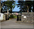
Entrance to Ynysybwl Cemetery
From Heol-y-Plwyf.
Image: © Jaggery Taken: 16 Apr 2015
0.04 miles
3
Ynysybwl Cemetery
A view from near the entrance. http://www.geograph.org.uk/photo/4431599 The cemetery is owned and managed by Rhondda Cynon Taf County Borough Council.
Image: © Jaggery Taken: 16 Apr 2015
0.08 miles
4
Ordnance Survey Cut Mark
This OS cut mark can be found on the wall of Minawel, Clydach Road. It marks a point 149.511m above mean sea level.
Image: © Adrian Dust Taken: 1 Mar 2021
0.14 miles
5
Buarth-y-Capel, Ynysybwl
From Glanffrwd Terrace. The sign on the left shows that this is the way to numbers 1-72 Buarth-y-Capel.
Image: © Jaggery Taken: 16 Apr 2015
0.15 miles
6
Barrier at the edge of Clydach Road, Ynysybwl
At the edge of a stream, Nant Clydach.
Image: © Jaggery Taken: 16 Apr 2015
0.16 miles
7
Hole in the roof, Ynysybwl
A building at the edge of the B4273 Clydach Road.
Image: © Jaggery Taken: 16 Apr 2015
0.17 miles
8
Clydach Road descends into the valley of Nant Clydach, Ynysybwl
The B4273 Clydach Road here is above Clydach Park which is at the edge of a stream, Nant Clydach.
Image: © Jaggery Taken: 16 Apr 2015
0.17 miles
9
No diving and no photography signs in Clydach Park, Ynysybwl
Viewed when there are neither water nor paddlers in the park's paddling pool. The shallowness of the pool shows the reason for the no diving sign.
Image: © Jaggery Taken: 16 Apr 2015
0.17 miles
10
Paddling pool in Clydach Park, Ynysybwl
Not yet refilled in mid April 2015 after being drained for the winter.
Image: © Jaggery Taken: 16 Apr 2015
0.17 miles
  • ...