
IMAGES TAKEN NEAR TO
Rogart Terrace, PONTYPRIDD, CF37 3BH
Introduction
This page details the photographs taken nearby to Rogart Terrace, CF37 3BH by members of the Geograph project.
The Geograph project started in 2005 with the aim of publishing, organising and preserving representative images for every square kilometre of Great Britain, Ireland and the Isle of Man.

There are currently over 7.5m images from over14,400 individuals and you can help contribute to the project by visiting https://www.geograph.org.uk
Image Map
Images are licensed for reuse under creativecommons.org/licenses/by-sa/2.0
Notes
- Clicking on the map will re-center to the selected point.
- The higher the marker number, the further away the image location is from the centre of the postcode.
Image Listing (6 Images Found)
Images are licensed for reuse under creativecommons.org/licenses/by-sa/2.0
Image
Details
Distance
1
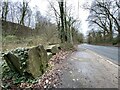
Large boulders
Large rocks alongside the B4273 towards Ynysybwl.
Image: © Alan Hughes
Taken: 1 Feb 2021
0.06 miles
2

Craig-yr-Hesg Quarry from Cefn Eglywsilan
Image: © Gareth James
Taken: 30 Jul 2016
0.07 miles

5
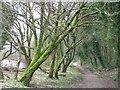
Trees flanking Taff Trail path
A pleasant tree lined section of the Taff Trail between Pontypridd and Cilfynydd. However, the busy A470 runs parallel about ten metres out of shot to the right so the route is not quiet!
Image: © John Light
Taken: 4 Jan 2013
0.24 miles
6
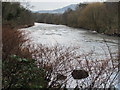
River Taff looking downstream near Cilfynydd
Taken from by the Taff Trail.
Image: © John Light
Taken: 4 Jan 2013
0.25 miles