
IMAGES TAKEN NEAR TO
Plas Carmel, Graigwen Road, PONTYPRIDD, CF37 2TX
Introduction
This page details the photographs taken nearby to Plas Carmel, Graigwen Road, CF37 2TX by members of the Geograph project.
The Geograph project started in 2005 with the aim of publishing, organising and preserving representative images for every square kilometre of Great Britain, Ireland and the Isle of Man.

There are currently over 7.5m images from over14,400 individuals and you can help contribute to the project by visiting https://www.geograph.org.uk
Image Map
Images are licensed for reuse under creativecommons.org/licenses/by-sa/2.0
Notes
- Clicking on the map will re-center to the selected point.
- The higher the marker number, the further away the image location is from the centre of the postcode.
Image Listing (241 Images Found)
Images are licensed for reuse under creativecommons.org/licenses/by-sa/2.0
Image
Details
Distance
1
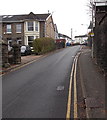
Lower end of a long steep hill in Pontypridd
Looking up Graigwen Road towards the corner of Tyfica Road, where
a triangular sign facing uphill shows a gradient of 18% (between 1 in 5 and 1 in 6).
Image: © Jaggery
Taken: 25 Nov 2014
0.03 miles
2
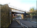
Mill Street railway bridge, Pontypridd
The Rhondda Line railway crosses over Mill Street.
Image: © Jaggery
Taken: 12 Jan 2012
0.04 miles
3
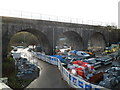
NW end of the Rhondda Line railway viaduct, Pontypridd
Viewed from the A4058.
Image: © Jaggery
Taken: 12 Jan 2012
0.04 miles
4
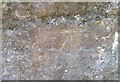
Ordnance Survey Cut Mark
This OS cut mark can be found on the SW buttress of the railway bridge. It marks a point 65.462m above mean sea level.
Image: © Adrian Dust
Taken: 23 Jun 2018
0.04 miles
5
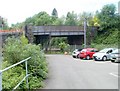
Thomas Street bridge, Pontypridd
Viewed from the SW edge of Goods Yard car park. A bridge carries Thomas Street over railway lines.
Image: © Jaggery
Taken: 11 May 2011
0.05 miles
6
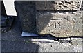
Ordnance Survey Cut Mark
This OS cut mark can be found on the north parapet of the bridge on Mill Street. It marks a point 62.676m above mean sea level.
Image: © Adrian Dust
Taken: 23 Jun 2018
0.05 miles
7
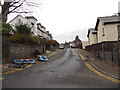
Western end of Tyfica Road, Pontypridd
Tyfica Road climbs away from Graigwen Road.
Image: © Jaggery
Taken: 25 Nov 2014
0.06 miles
8
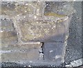
Ordnance Survey Cut Mark
This OS cut mark can be found on the wall of No1 Graigwen Place. It marks a point 88.733m above mean sea level.
Image: © Adrian Dust
Taken: 23 Jun 2018
0.06 miles
9
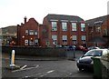
Northern side of Ysgol Gynradd Gymraeg Evan James, Pontypridd
The school is located between the A4058 and the River Rhondda.
The school is a Welsh medium primary school, where all lessons are taught using the medium of the Welsh language.
Image: © Jaggery
Taken: 12 Jan 2012
0.07 miles
10
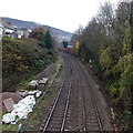
Railway towards Pontypridd Station
Viewed from this http://www.geograph.org.uk/photo/4258530 bridge. Out of shot, the NW edge of Pontypridd Railway Station is 400 metres from the bridge.
Image: © Jaggery
Taken: 25 Nov 2014
0.07 miles