1
Llwyn Castan in Pontypridd
Llwyn Castan is Rhondda Cynon Taf Council's Environmental Services office in Library Road.
Text on the side of the Openreach van shows 'A BT Group business'.
Openreach is the infrastructure division of the telecommunications company.
Image: © Jaggery
Taken: 25 Nov 2014
0.02 miles
2
Pontypridd Central Library
Located in Library Road, part of the Rhondda Cynon Taf Council's library service.
Image: © Jaggery
Taken: 25 Nov 2014
0.03 miles
3
Library Road side of The Co-operative Funeralcare in Pontypridd
This is the rear of the premises. The front is in Gelliwastad Road. http://www.geograph.org.uk/photo/4260739
Image: © Jaggery
Taken: 25 Nov 2014
0.03 miles
4
Across Thomas Street railway bridge, Pontypridd
Looking towards Gelliwastad Grove across this http://www.geograph.org.uk/photo/2404613 bridge over a railway.
Image: © Jaggery
Taken: 25 Nov 2014
0.03 miles
5
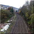
Railway towards Pontypridd Station
Viewed from this http://www.geograph.org.uk/photo/4258530 bridge. Out of shot, the NW edge of Pontypridd Railway Station is 400 metres from the bridge.
Image: © Jaggery
Taken: 25 Nov 2014
0.04 miles
6
St Catherine's Vicarage, Pontypridd
Located in Gelliwastad Grove, on the NW side of the church, http://www.geograph.org.uk/photo/4260817, the vicarage was
completed in 1890. Beneath the gable, painted stonework and two small windows depict a cross.
Image: © Jaggery
Taken: 25 Nov 2014
0.04 miles
7
Grove House, Pontypridd
Office building on the north side of Gelliwastad Grove.
Image: © Jaggery
Taken: 25 Nov 2014
0.04 miles
8
Library, Pontypridd
Image: © John Lord
Taken: 3 Mar 2012
0.04 miles
9
Ordnance Survey Cut Mark
This OS cut mark can be found on the wall SW side of Thomas Street. It marks a point 77.224m above mean sea level.
Image: © Adrian Dust
Taken: 23 Jun 2018
0.04 miles
10
Pontypridd Indoor Bowls Centre
Or Indoor Bowling Centre - the large orange letters disagree with the name sign below. Located in a converted railway building in the Old Goods Yard (surrounded by Goods Yard car park), on the west side of Gelliwastad Road (A4223).
Image: © Jaggery
Taken: 11 May 2011
0.04 miles


