
IMAGES TAKEN NEAR TO
Graig-y-Fforest, PONTYPRIDD, CF37 1UA
Introduction
This page details the photographs taken nearby to Graig-y-Fforest, CF37 1UA by members of the Geograph project.
The Geograph project started in 2005 with the aim of publishing, organising and preserving representative images for every square kilometre of Great Britain, Ireland and the Isle of Man.

There are currently over 7.5m images from over14,400 individuals and you can help contribute to the project by visiting https://www.geograph.org.uk
Image Map
Images are licensed for reuse under creativecommons.org/licenses/by-sa/2.0
Notes
- Clicking on the map will re-center to the selected point.
- The higher the marker number, the further away the image location is from the centre of the postcode.
Image Listing (21 Images Found)
Images are licensed for reuse under creativecommons.org/licenses/by-sa/2.0
Image
Details
Distance
2
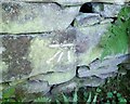
Ordnance Survey Cut Mark
This OS cut mark can be found on the wall east side of the track inside the wood. It marks a point 163.303m above mean sea level.
Image: © Adrian Dust
Taken: 23 Jun 2018
0.11 miles
3
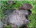
Ordnance Survey Pivot
This OS pivot can be found on a rock south side of the track inside the wood. It marks a point 174.093m above mean sea level.
Image: © Adrian Dust
Taken: 23 Jun 2018
0.14 miles
4
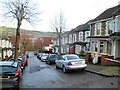
Bertha Street, Treforest, Pontypridd
Viewed looking towards Llantwit Road.
Image: © Jaggery
Taken: 12 Jan 2012
0.16 miles
5
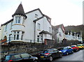
Forest Grove, Treforest, Pontypridd
The houses face the southern edge of the Treforest campus of the University of Glamorgan.
Image: © Jaggery
Taken: 12 Jan 2012
0.18 miles
6
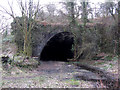
Tunnel portal near Treforest
The tunnel carried the mill race to the tin plate works.
Image: © Gareth James
Taken: 28 Feb 2016
0.19 miles
7
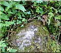
Ordnance Survey Rivet
This OS rivet can be found on a stone NE side of the road. It marks a point 132.463m above mean sea level.
Image: © Adrian Dust
Taken: 23 Jun 2018
0.19 miles
8
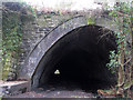
Tunnel portal near Treforest
The tunnel carried the mill race to the tin plate works, which were located at the far end of the tunnel, where the light can be seen.
Image: © Gareth James
Taken: 28 Feb 2016
0.19 miles
9
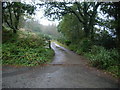
The end of Gwenllian Terrace
This is where Gwenllian Terrace becomes a track
Image: © Nick Mutton 01329 000000
Taken: 23 Sep 2007
0.20 miles
10
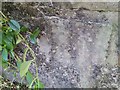
Ordnance Survey Cut Mark
This OS cut mark can be found on the wall of The Lodge at the junction of Forest Grove & Llantwit Road. It marks a point 65.706m above mean sea level.
Image: © Adrian Dust
Taken: 23 Jun 2018
0.20 miles