1
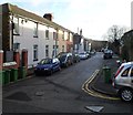
Cliff Terrace, Pontypridd
A view SE from the edge of a former synagogue. http://www.geograph.org.uk/photo/3208830
Image: © Jaggery
Taken: 12 Jan 2012
0.02 miles
2
Broadway Van Centre, Treforest
Located near the western end of Broadway. The part of the premises in view was formerly a Total fuel filling station.
Image: © Jaggery
Taken: 9 Dec 2011
0.03 miles
3
Calvary, a church on a hill, Treforest
Calvary Baptist Church, Cliff Terrace, viewed from Broadway. The church was built in 1851-1852 as Calvary English Baptist Church, "English" signifying the language used for the services in an era when Welsh was more widely spoken in Treforest than it is today. When the church first opened, the surrounding area was heavily wooded, with very few dwellings nearby. It was considered a dangerous place to be at night.
Image: © Jaggery
Taken: 9 Dec 2011
0.04 miles
4
Two shops on the corner of Tower Street and Laura Street, Pontypridd
The shop on the right, with a TO LET board on the door, was formerly the premises of Crafty Changes,
a craft shop. The shop on the left shows the name Hazel's. The windows are shuttered (early Thursday afternoon) and a board showing a phone number is badly faded. Formerly a hairdressers, perhaps?
Image: © Jaggery
Taken: 12 Jan 2012
0.04 miles
5
Calvary Baptist Church
English Baptist Church on Cliff Terrace overlooking the railway line at Treforest.
Image: © Alan Hughes
Taken: 19 Jan 2019
0.04 miles
6
Tower Street, Pontypridd
Tower Street climbs away from Stow Hill.
Image: © Jaggery
Taken: 12 Jan 2012
0.04 miles
7
Railway underpass, Treforest
Set back from the southwest side of the A473 Broadway
between Treforest station and Pontypridd station.
Image: © Jaggery
Taken: 8 Mar 2019
0.05 miles
8
The Trade Centre advert alongside the A473 Broadway, Treforest
On March 8th 2019 an advert for The Trade Centre is on display on a Primesight advertising site.
Three 2016 cars are depicted - a Peugeot 108, Vauxhall Corsa, VW Up.
Image: © Jaggery
Taken: 8 Mar 2019
0.05 miles
9
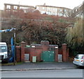
Broadway urinal, Treforest
Basic facility for males (no pedestals or wash basin) located next to Broadway Van Centre. http://www.geograph.org.uk/photo/2756692
The hilltop houses are on Cliff Terrace.
Image: © Jaggery
Taken: 9 Dec 2011
0.06 miles
10
Army Reserve Centre direction sign, Broadway, Treforest
Pointing towards Alexandra Road https://www.geograph.org.uk/photo/6082598 the sign shows that
Army Reserve Centre is Canolfan Milwyr wrth Gefn y Fyddin in Welsh.
Image: © Jaggery
Taken: 8 Mar 2019
0.06 miles


