1
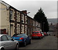
Lewis Street, Graig, Pontypridd
A short dead-end street on the north side of Rickards Street.
Image: © Jaggery
Taken: 19 Nov 2014
0.01 miles
2
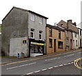
Josie's News, Pontypridd
General stores and greetings cards shop at 21 High Street, Graig, Pontypridd.
Image: © Jaggery
Taken: 3 May 2014
0.02 miles
3
Up High Street, Graig, Pontypridd
Viewed from platform 2 at Pontypridd railway station looking up High Street, Graig
past the Graig boundary sign in the foreground. The left turn is into Union Street.
Image: © Jaggery
Taken: 27 Mar 2014
0.02 miles
4
High Street, Graig, Pontypridd
Viewed from platform 2 at Pontypridd railway station. The railway station sign
on the right is at the edge of this http://www.geograph.org.uk/photo/3966932 path to the station.
Image: © Jaggery
Taken: 27 Mar 2014
0.02 miles
5
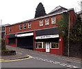
Delight Barbers in Pontypridd
Viewed across High Street from Union Street. The nameboard shows Traditional Turkish Barber Shop.
I wondered how that differed from a Traditional British Barber Shop.
Perhaps football, politics etc discussions are available in Turkish...
Image: © Jaggery
Taken: 19 Nov 2014
0.02 miles
6
Ordnance Survey Rivet
This OS rivet can be found on the wall of the steps near the Masonic buildings. It marks a point 75.664m above mean sea level.
Image: © Adrian Dust
Taken: 23 Jun 2018
0.03 miles
7
Pontypridd Magistrates? Court
Located in Union Street.
Image: © Jaggery
Taken: 12 Jan 2012
0.03 miles
8
High Street railway and station bridge, Pontypridd
The central part of Pontypridd railway station is on this 3.9 metre (13 feet) high bridge across High Street. Viewed looking towards Sardis Road.
Image: © Jaggery
Taken: 9 Dec 2011
0.03 miles
9
Pontypridd Masonic Hall
Located on Courthouse Street, near the High Street junction.
Image: © Jaggery
Taken: 9 Dec 2011
0.03 miles
10
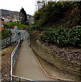
Station access path, Pontypridd
Viewed from platform 2 at Pontypridd railway station looking towards High Street, Graig.
Image: © Jaggery
Taken: 27 Mar 2014
0.04 miles


