IMAGES TAKEN NEAR TO
Maesycoed, PONTYPRIDD, CF37 1QB
Introduction
This page details the photographs taken nearby to CF37 1QB by members of the Geograph project.
The Geograph project started in 2005 with the aim of publishing, organising and preserving representative images for every square kilometre of Great Britain, Ireland and the Isle of Man.

There are currently over 7.5m images from over14,400 individuals and you can help contribute to the project by visiting https://www.geograph.org.uk
Image Map
Images are licensed for reuse under creativecommons.org/licenses/by-sa/2.0
Notes
- Clicking on the map will re-center to the selected point.
- The higher the marker number, the further away the image location is from the centre of the postcode.
Image Listing (15 Images Found)
Images are licensed for reuse under creativecommons.org/licenses/by-sa/2.0
Image
Details
Distance
1
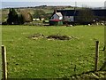
Ty Draw Farm
View across the field towards Ty Draw Farm.
Image: © Alan Hughes
Taken: 9 Mar 2017
0.00 miles
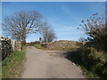
3
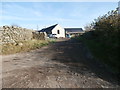
Ty-draw Farm, Gelliwion Rd, near Pontypridd
Image: © John Lord
Taken: 30 Oct 2017
0.05 miles
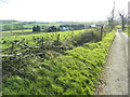
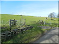
5
Gelliwion Rd at the entrance to Ty-draw Farm, near Pontypridd
Image: © John Lord
Taken: 30 Oct 2017
0.06 miles
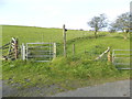
6
Gate to footpath, near Ty-draw Farm, Gelliwion Rd
Image: © John Lord
Taken: 30 Oct 2017
0.10 miles
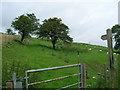
7
Gate to footpath, Gelliwion Rd, near Ty-draw Farm
Image: © John Lord
Taken: 30 Oct 2017
0.11 miles
8
Sheep grazing on pasture land above Ty-draw
Looking north from the bend in the road to Gelli-wion.
Image: © Simon Mortimer
Taken: 8 Aug 2012
0.13 miles
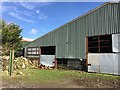
9
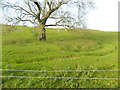
Old wheel-tracks circling a tree, on pasture
Image: © John Lord
Taken: 30 Oct 2017
0.13 miles
10
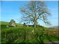
Sheep, a tree, and a ruined stone building, Gelli-wion
Image: © John Lord
Taken: 30 Oct 2017
0.16 miles