
IMAGES TAKEN NEAR TO
Llantrisant Road, PONTYPRIDD, CF37 1PG
Introduction
This page details the photographs taken nearby to Llantrisant Road, CF37 1PG by members of the Geograph project.
The Geograph project started in 2005 with the aim of publishing, organising and preserving representative images for every square kilometre of Great Britain, Ireland and the Isle of Man.

There are currently over 7.5m images from over14,400 individuals and you can help contribute to the project by visiting https://www.geograph.org.uk
Image Map
Images are licensed for reuse under creativecommons.org/licenses/by-sa/2.0
Notes
- Clicking on the map will re-center to the selected point.
- The higher the marker number, the further away the image location is from the centre of the postcode.
Image Listing (24 Images Found)
Images are licensed for reuse under creativecommons.org/licenses/by-sa/2.0
Image
Details
Distance
1
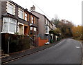
Woodland Villas and Woodland Place south of Graig, Pontypridd
Alongside Llantrisant Road. Woodland Villas and Woodland Place are both two semi-detached houses.
Image: © Jaggery
Taken: 19 Nov 2014
0.02 miles
2
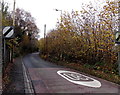
End of the 30 zone south of Graig, Pontypridd
The 30mph speed limit along Llantrisant Road increases to the National Speed Limit.
Image: © Jaggery
Taken: 19 Nov 2014
0.02 miles
3
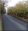
10% gradient on Llantrisant Road south of Graig, Pontypridd
Nearby signs show a 10% (1 in 10) gradient.
Image: © Jaggery
Taken: 19 Nov 2014
0.05 miles
4
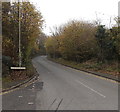
Llantrisant Road south of Danycoedcae Road near Pontypridd
Viewed from this junction. http://www.geograph.org.uk/photo/4252813 The road climbs away from Graig and from Pontypridd.
Highland Farm and Hilltop Cottages are ahead.
Image: © Jaggery
Taken: 19 Nov 2014
0.08 miles
5
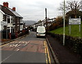
Welcome to Graig, Pontypridd
Llantrisant Road descends into the SW edge of Graig, one of the electoral wards of Pontypridd.
Image: © Jaggery
Taken: 19 Nov 2014
0.13 miles
6
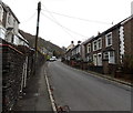
Heading out of Graig, Pontypridd
Llantrisant Road climbs towards the boundary sign http://www.geograph.org.uk/photo/4252811 near the distant parked vehicles.
Image: © Jaggery
Taken: 19 Nov 2014
0.13 miles
7

View from near Pen-y-rhiw
Pantygraig Wen and Penygraigwen on the hillside in the distance.
Image: © John Lord
Taken: 18 Feb 2012
0.13 miles
8
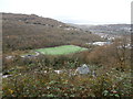
Football ground near the Maritime Industrial Estate, Pontypridd
Image: © John Lord
Taken: 28 Oct 2017
0.13 miles

10
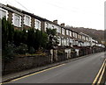
Llantrisant Road south of Graig Avenue, Graig, Pontypridd
Viewed from opposite the Graig Avenue junction. http://www.geograph.org.uk/photo/4252807
These houses on the east side of the road are set above pavement level.
Image: © Jaggery
Taken: 19 Nov 2014
0.16 miles