1
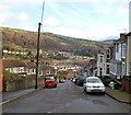
Tower Street, Pontypridd
Tower Street climbs away from Stow Hill.
Image: © Jaggery
Taken: 12 Jan 2012
0.02 miles
2
Pen yr Ysgol houses, Treforest, Pontypridd
Recently-built houses viewed from the top of Stow Hill.
Image: © Jaggery
Taken: 12 Jan 2012
0.04 miles
3
Stow Hill, Pontypridd
Stow Hill climbs away from the corner of Tower Street.
Image: © Jaggery
Taken: 12 Jan 2012
0.05 miles
4
Calvary, a church on a hill, Treforest
Calvary Baptist Church, Cliff Terrace, viewed from Broadway. The church was built in 1851-1852 as Calvary English Baptist Church, "English" signifying the language used for the services in an era when Welsh was more widely spoken in Treforest than it is today. When the church first opened, the surrounding area was heavily wooded, with very few dwellings nearby. It was considered a dangerous place to be at night.
Image: © Jaggery
Taken: 9 Dec 2011
0.05 miles
5
Calvary Baptist Church
English Baptist Church on Cliff Terrace overlooking the railway line at Treforest.
Image: © Alan Hughes
Taken: 19 Jan 2019
0.05 miles
6
Corner of Tower Street and Stow Hill, Pontypridd
A triangular hedge occupies the corner of Tower Street on the right and Stow Hill on the left.
Image: © Jaggery
Taken: 12 Jan 2012
0.06 miles
7
Central Guest House, Treforest, Pontypridd
Located at the top of Stow Hill.
Image: © Jaggery
Taken: 12 Jan 2012
0.06 miles
8
Parc Lewis Primary School, Treforest
The school is on the NE side of Broadway.
Image: © Jaggery
Taken: 9 Dec 2011
0.07 miles
9
Groggs, Treforest
Premises at 159-160 Broadway, Treforest.
Established in 1965, Groggs design, create and sell hand-sculpted figurine caricatures of subjects such as miners, sports celebrities, film stars and pop stars. There are also humorous figurines of sheep and dragons.
Now exported to many countries, Groggs were first designed and made by John Hughes, who became famous in 1971 for his figurines of rugby stars Gareth Edwards and JPR Williams. Groggs auctions have raised thousands of pounds for charity.
Image: © Jaggery
Taken: 9 Dec 2011
0.07 miles
10
Down Stow Hill, Treforest, Pontypridd
Stow Hill descends towards Tower Street.
Image: © Jaggery
Taken: 12 Jan 2012
0.07 miles


