1
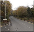
Llantrisant Road south of Danycoedcae Road near Pontypridd
Viewed from this junction. http://www.geograph.org.uk/photo/4252813 The road climbs away from Graig and from Pontypridd.
Highland Farm and Hilltop Cottages are ahead.
Image: © Jaggery
Taken: 19 Nov 2014
0.02 miles
2
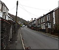
Welcome to Graig, Pontypridd
Llantrisant Road descends into the SW edge of Graig, one of the electoral wards of Pontypridd.
Image: © Jaggery
Taken: 19 Nov 2014
0.07 miles
3
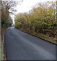
Heading out of Graig, Pontypridd
Llantrisant Road climbs towards the boundary sign http://www.geograph.org.uk/photo/4252811 near the distant parked vehicles.
Image: © Jaggery
Taken: 19 Nov 2014
0.07 miles
4
Dan-y-coedcae Rd, Graig, Pontypridd
Image: © John Lord
Taken: 18 Feb 2012
0.07 miles
5
Woodland Villas and Woodland Place south of Graig, Pontypridd
Alongside Llantrisant Road. Woodland Villas and Woodland Place are both two semi-detached houses.
Image: © Jaggery
Taken: 19 Nov 2014
0.09 miles
6
End of the 30 zone south of Graig, Pontypridd
The 30mph speed limit along Llantrisant Road increases to the National Speed Limit.
Image: © Jaggery
Taken: 19 Nov 2014
0.09 miles
7
Llantrisant Road south of Graig Avenue, Graig, Pontypridd
Viewed from opposite the Graig Avenue junction. http://www.geograph.org.uk/photo/4252807
These houses on the east side of the road are set above pavement level.
Image: © Jaggery
Taken: 19 Nov 2014
0.09 miles
8
Danycoedcae Road, Graig, Pontypridd
Viewed across Llantrisant Road at the southern edge of Graig. The boundary sign is on the left.
Image: © Jaggery
Taken: 19 Nov 2014
0.10 miles
9
10% gradient on Llantrisant Road south of Graig, Pontypridd
Nearby signs show a 10% (1 in 10) gradient.
Image: © Jaggery
Taken: 19 Nov 2014
0.12 miles
10
Football ground near the Maritime Industrial Estate, Pontypridd
Image: © John Lord
Taken: 28 Oct 2017
0.14 miles


