IMAGES TAKEN NEAR TO
Barry Road, PONTYPRIDD, CF37 1HY

Introduction

This page details the photographs taken nearby to Barry Road, CF37 1HY by members of the Geograph project.

The Geograph project started in 2005 with the aim of publishing, organising and preserving representative images for every square kilometre of Great Britain, Ireland and the Isle of Man.

There are currently over 7.5m images from over14,400 individuals and you can help contribute to the project by visiting https://www.geograph.org.uk

Image Map


Images are licensed for reuse under creativecommons.org/licenses/by-sa/2.0
Notes
  • Clicking on the map will re-center to the selected point.
  • The higher the marker number, the further away the image location is from the centre of the postcode.

Image Listing (58 Images Found)

Images are licensed for reuse under creativecommons.org/licenses/by-sa/2.0
  • ...
Image
Details
Distance
1
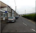
Barry Road, Pontypridd
Looking WNW from the Pwllgwaun Road and Maesycoed Road junction.
Image: © Jaggery Taken: 19 Nov 2014
0.03 miles
2
Derelict building in Pwllgwaun, Pontypridd
Viewed through a fenced enclosure beyond the NW end of Seaton Street in November 2014. One map names the building Ty Gwyn Psychological Centre. The site looks to have been unused for some time.
Image: © Jaggery Taken: 19 Nov 2014
0.05 miles
3
St Mark's Villas, Pwllgwaun, Pontypridd
A dozen or so separately-named houses at the western end of Seaton Street.
Image: © Jaggery Taken: 19 Nov 2014
0.05 miles
4
Barry Road
Image: © Colin Pyle Taken: 4 Jan 2010
0.05 miles
5
Seaton Street, Pwllgwaun, Pontypridd
From the Maesycoed Road end.
Image: © Jaggery Taken: 19 Nov 2014
0.05 miles
6
Path into Barry Sidings Country Park, Pontypridd
From this http://www.geograph.org.uk/photo/4254069 entrance. The path uses the trackbed of a dismantled railway.
Image: © Jaggery Taken: 19 Nov 2014
0.06 miles
7
Barry Road mini-roundabout.
Image: © Colin Pyle Taken: 4 Jan 2010
0.06 miles
8
Baptist Church
Bethany English Baptist Church, Pontypridd.
Image: © Alan Hughes Taken: 9 Mar 2017
0.07 miles
9
Vaughan Street, Pontypridd
Viewed from a bend in Vaughan Street, looking towards Upper Vaughan Street.
Image: © Jaggery Taken: 12 Jan 2012
0.07 miles
10
River Rhondda, Hopkinstown
Looking east.
Image: © Roger Cornfoot Taken: 25 Apr 2007
0.07 miles
  • ...