1
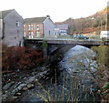
Pwllgwaun Road river bridge, Pontypridd
Viewed from the A4058 Rhondda Road. A bridge carries Pwllgwaun Road over the River Rhondda.
Image: © Jaggery
Taken: 12 Jan 2012
0.01 miles
2
Laundry Road, Pontypridd
Viewed from the Pwllgwaun Road end. Laundry Road is on the west bank of the River Rhondda.
Image: © Jaggery
Taken: 12 Jan 2012
0.02 miles
3
Valley Tyre Service, Pontypridd
The business is located on the River Rhondda side http://www.geograph.org.uk/photo/3442421 of Vaughan Street.
Image: © Jaggery
Taken: 12 Jan 2012
0.02 miles
4
Grade II listed The Merlin, Pontypridd
Large pub located on the corner of Pwllgwaun Road and Vaughan Street, on the west bank of the River Rhondda. Dominating the corner of the pub is a representation of a full-bearded Merlin holding a harp.
Grade II listed in July 1990 (as The Merlin Hotel).
Image: © Jaggery
Taken: 12 Jan 2012
0.02 miles
5
Lee Street, Pontypridd
Viewed from Pwllgwaun Road looking along Lee Street towards Laundry Road.
Image: © Jaggery
Taken: 12 Jan 2012
0.02 miles
6
Up local from Treherbert entering Pontypridd
View from the north end of the station, where the ex-Taff Vale Railway line from Treherbert down the Rhondda Valley joins that from Merthyr down the Taff Valley; also round behind a loop joins the two and each line crosses a viaduct over the respective rivers here. It was a site of constant railway activity and the train is typical of the times, with Collett '5600' class No. 6648 (built 9/28, withdrawn 5/65) working bunker-first down to Cardiff.
Image: © Ben Brooksbank
Taken: 6 Apr 1954
0.03 miles
7
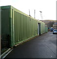
Corrugated metal building, Laundry Road, Pontypridd
Located opposite the Lee Street junction. There was no name sign to indicate the use of this building.
Image: © Jaggery
Taken: 12 Jan 2012
0.03 miles
8
The river side of Valley Tyre Service Ltd, Pontypridd
Viewed across the Rhondda from the A4058 Rhondda Road. The business's frontage is in Vaughan Street. http://www.geograph.org.uk/photo/3442743
Image: © Jaggery
Taken: 12 Jan 2012
0.04 miles
9
The Merlin Hotel, Pwllgwaun Road, Pontypridd
Image: © Roger Cornfoot
Taken: 14 Mar 2009
0.05 miles
10
Vaughan Street, Pontypridd
Viewed across Pwllgwaun Road looking past The Merlin. http://www.geograph.org.uk/photo/3442449
This part of Vaughan Street is on the west bank of the River Rhondda.
Image: © Jaggery
Taken: 12 Jan 2012
0.05 miles


