
IMAGES TAKEN NEAR TO
Fay Court, PONTYPRIDD, CF37 1FA
Introduction
This page details the photographs taken nearby to Fay Court, CF37 1FA by members of the Geograph project.
The Geograph project started in 2005 with the aim of publishing, organising and preserving representative images for every square kilometre of Great Britain, Ireland and the Isle of Man.

There are currently over 7.5m images from over14,400 individuals and you can help contribute to the project by visiting https://www.geograph.org.uk
Image Map
Images are licensed for reuse under creativecommons.org/licenses/by-sa/2.0
Notes
- Clicking on the map will re-center to the selected point.
- The higher the marker number, the further away the image location is from the centre of the postcode.
Image Listing (79 Images Found)
Images are licensed for reuse under creativecommons.org/licenses/by-sa/2.0
Image
Details
Distance
1
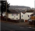
Fay Court, Pontypridd
Flats on the east side of Lanelay Terrace.
Image: © Jaggery
Taken: 19 Nov 2014
0.01 miles
2
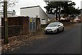
Lanelay Terrace electricity substation, Pontypridd
The identifier on the Western Power Distribution electricity substation is
LANELAY TERRACE S/S 541036.
Image: © Jaggery
Taken: 19 Nov 2014
0.03 miles

4
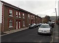
Row of houses, Lanelay Terrace, Pontypridd
The 40 metre long row is on the east side of Lanelay Terrace.
Image: © Jaggery
Taken: 19 Nov 2014
0.05 miles
5
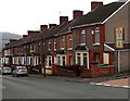
Mound Road houses, Pontypridd
On the south side of Mound Road, east of the Rosser Street junction. http://www.geograph.org.uk/photo/4253893
Image: © Jaggery
Taken: 19 Nov 2014
0.05 miles
6
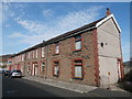
Houses in Lanelay Terrace, Maesycoed, Pontypridd
Image: © John Lord
Taken: 30 Oct 2017
0.05 miles
7
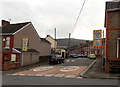
Northern end of Rosser Street, Pontypridd
Viewed across Mound Road. A 20mph maximum speed zone applies
along Rosser Street, on the approach to Maes-y-Coed Primary School.
Image: © Jaggery
Taken: 19 Nov 2014
0.06 miles
8
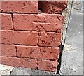
Ordnance Survey Cut Mark
This OS cut mark can be found on No2 Hurford Street. It marks a point 105.379m above mean sea level.
Image: © Adrian Dust
Taken: 23 Jun 2018
0.07 miles
9
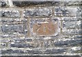
Ordnance Survey Cut Mark
This OS cut mark can be found on the wall of No3 Lanelay Crescent. It marks a point 81.068m above mean sea level.
Image: © Adrian Dust
Taken: 23 Jun 2018
0.08 miles
10
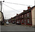
Hurford Street, Maesycoed, Pontypridd
Viewed across Mound Street.
Image: © Jaggery
Taken: 19 Nov 2014
0.08 miles