1
Manor Farm
Heavily disguised as a trip of woodland the farm is viewed from the lane located to the west.
Image: © Chris Shaw
Taken: 26 Jul 2006
0.06 miles
2
Construction to the north of Tyn-y-caeau Lane
Viewed from the Porthcawl area lane, a large structure of what appears to be scaffolding covered with plastic sheeting dominates a construction site in the countryside.
Image: © eswales
Taken: 10 Apr 2015
0.07 miles
3
Entrance to Manor Farm near Porthcawl
From the A4106 Bridgend Road. This is a private entrance road - no through road.
Image: © Jaggery
Taken: 29 Mar 2016
0.09 miles
4
Roadside cabinet near Porthcawl
On the north side of the A4106 Bridgend Road.
Notices on the cabinet state Thieves Beware. Smartwater forensic trap devices in use.
Police and scrap dealers are checking metal for Smartwater.
Image: © Jaggery
Taken: 29 Mar 2016
0.11 miles
5
A view from Tyn-y-caeau Lane
A view from a spot on the Porthcawl area lane near its south eastern end.
Image: © eswales
Taken: 10 Apr 2015
0.13 miles
6
Northeast boundary of Porthcawl
The A4106 reaches Porthcawl, a holiday resort coastal town in the county borough of Bridgend.
Porthcawl's population was 16,005 on the day of the 2011 Census.
Image: © Jaggery
Taken: 29 Mar 2016
0.14 miles
7
Driveway to Manor Farm Cottage
Driveway to Manor Farm cottage, near Porthcawl.
Image: © Alan Hughes
Taken: 19 Jan 2016
0.15 miles
8
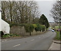
Down Bridgend Road towards the centre of Porthcawl
The A4106 Bridgend Road descends past The Lodge http://www.geograph.org.uk/photo/5250427 on the left.
Image: © Jaggery
Taken: 29 Mar 2016
0.15 miles
9
Warning sign - Disabled People near Porthcawl
The triangular sign faces the A4106. The sign is most often used
to warn of elderly people nearby, but here the text is Disabled People.
Image: © Jaggery
Taken: 29 Mar 2016
0.16 miles
10
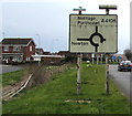
Directions sign on the approach to Porthcawl
Alongside the A4106. Manor Grove is on the left.
Image: © Jaggery
Taken: 29 Mar 2016
0.17 miles


