1
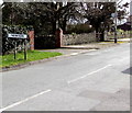
Hookland Road, Porthcawl
Viewed across Newton Nottage Road.
Image: © Jaggery
Taken: 29 Mar 2016
0.01 miles
2
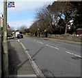
St Michael's Road in Newton
Image: © Roger Davies
Taken: 24 Jul 2012
0.04 miles
3
Newton boundary sign, Porthcawl
Facing Newton Nottage Road. Formerly a separate village, Newton is part of Porthcawl. Some references still refer to Newton village.
Image: © Jaggery
Taken: 29 Mar 2016
0.05 miles
4
Bellway show homes, Mallards Reach, Porthcawl
Part of a Bellway development site viewed across Newton Nottage Road in late March 2016.
Image: © Jaggery
Taken: 29 Mar 2016
0.05 miles
5
X2 bus stop, Newton Nottage Road, Porthcawl
The bus stop sign shows CYMRU CLIPPER X2. Operated by First South & West Wales,
buses on route X2 connect Porthcawl with Cardiff (via Bridgend and Cowbridge) seven days a week.
Image: © Jaggery
Taken: 29 Mar 2016
0.05 miles
6
Mallards Reach from Zig-zag Lane
Newly-built houses at the Mallards Reach development in the east of Porthcawl viewed from one of the area’s country lanes. Construction was ongoing at the site in April 2015 when the photo was taken.
Image: © eswales
Taken: 10 Apr 2015
0.06 miles
7
Clos y Mametz, Porthcawl
Houses in Bellway's Mallards Reach development viewed from Newtown Nottage Road in late March 2016. As the letter Z is not part of the Welsh alphabet, I guessed that perhaps Mametz is a town twinned with Porthcawl, but I was wrong.
The most likely reason for the name is as a memorial to the Battle of Mametz Wood, fought from July 7th to July 12th 1916 during the First Battle of the Somme in France during the First World War. Most of the British forces involved were Welsh from the 38th (Welsh) Division. It was a particularly fierce and bloody battle, which resulted in nearly 4,000 British casualties.
Image: © Jaggery
Taken: 29 Mar 2016
0.06 miles
8
Newton Institute Village Hall, Porthcawl
Image: © John Lord
Taken: 9 Aug 2018
0.07 miles
9
Newton Institute Village Hall, Newton Nottage Road, Porthcawl
The inscription above the doorway is NEWTON INSTITUTE 1901.
Image: © Jaggery
Taken: 29 Mar 2016
0.07 miles
10
Construction beside Meadow Lake, Porthcawl
House building was taking place to the east of the lake in September 2014.
Image: © eswales
Taken: 9 Sep 2014
0.08 miles


