1
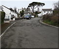
Greyfriars Court, Porthcawl
Cul-de-sac on the west side of Clevis Hill.
Image: © Jaggery
Taken: 29 Mar 2016
0.01 miles
2
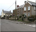
West side of Clevis Hill, Porthcawl
These houses on the west side of Clevis Hill are south of the corner of Greyfriars Court on the right.
Image: © Jaggery
Taken: 29 Mar 2016
0.04 miles
3
Old barn on a Porthcawl corner
On the corner of Heol-y-graig and Clevis Hill.
Image: © Jaggery
Taken: 29 Mar 2016
0.04 miles
4
Pine Close, Porthcawl
Cul-de-sac extending for 70 metres from the north side of Church Street.
Image: © Jaggery
Taken: 29 Mar 2016
0.05 miles
5
St John's Church, Newton, Porthcawl.
View from the south west
Image: © David Lewis
Taken: 2 Jan 2006
0.05 miles
6
Junction of Clevis Crescent and Clevis Lane, Porthcawl
The sign on the left shows that Clevis Lane is not a through route for motor vehicles. Out of shot ahead, Clevis Lane becomes narrower on the descent to Church Street and is a one-way lane (up from Church Street)
Image: © Jaggery
Taken: 29 Mar 2016
0.05 miles
7
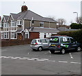
Blast Kiteboarding van in Porthcawl
Parked on the corner of Clevisfield Avenue and Clevis Crescent.
Blast Kiteboarding is based in Nicholls Avenue, Porthcawl.
Image: © Jaggery
Taken: 29 Mar 2016
0.06 miles
8
School Keep Clear Zone, Clevis Lane, Porthcawl
Marking a no stopping or parking area outside St Clare's School. http://www.geograph.org.uk/photo/5048577
Image: © Jaggery
Taken: 29 Mar 2016
0.06 miles
9
Northern end of Clevis Crescent, Porthcawl
Viewed across Bridgend Road.
Image: © Jaggery
Taken: 29 Mar 2016
0.07 miles
10
St Clare's Prayer and Retreat Centre, Porthcawl
Viewed across Clevis Lane. The Archdiocese of Cardiff website states that the Centre is based in a 16th century house next to St Clare's School. http://www.geograph.org.uk/photo/5048577 Run by the Sisters of St Clare, the Centre has 14 acres of grounds and a walled garden which is relaxing and peaceful. The Centre offers a retreat destination for all denominations with day or residential courses available.
Image: © Jaggery
Taken: 29 Mar 2016
0.07 miles


