
IMAGES TAKEN NEAR TO
St. Davids Way, PORTHCAWL, CF36 5HA
Introduction
This page details the photographs taken nearby to St. Davids Way, CF36 5HA by members of the Geograph project.
The Geograph project started in 2005 with the aim of publishing, organising and preserving representative images for every square kilometre of Great Britain, Ireland and the Isle of Man.

There are currently over 7.5m images from over14,400 individuals and you can help contribute to the project by visiting https://www.geograph.org.uk
Image Map
Images are licensed for reuse under creativecommons.org/licenses/by-sa/2.0
Notes
- Clicking on the map will re-center to the selected point.
- The higher the marker number, the further away the image location is from the centre of the postcode.
Image Listing (64 Images Found)
Images are licensed for reuse under creativecommons.org/licenses/by-sa/2.0
Image
Details
Distance
1
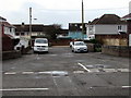
Unnamed side street, Porthcawl
Extending for 35 metres from the south side of the A4106 Newton Nottage Road.
Image: © Jaggery
Taken: 4 Mar 2017
0.04 miles
3
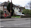
King George VI postbox in a Porthcawl wall
On the south side of the A4106 Newton Nottage Road.
King George VI reigned from December 11th 1936 to February 6th 1952.
Image: © Jaggery
Taken: 4 Mar 2017
0.06 miles
4
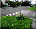
Daffodils around an old stone, Porthcawl
Alongside the A4106 Newton Nottage Road, viewed on March 4th 2017. The stone may once have been a milestone. Weathering has removed any inscription which may have been on the stone.
Image: © Jaggery
Taken: 4 Mar 2017
0.07 miles
5
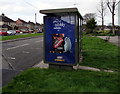
McVitie's advert on a Porthcawl bus shelter
The advert for McVitie's Digestives Nibbles is on a Clear Channel advertising site
on the side of a bus shelter alongside the A4106 Newton Nottage Road in early March 2017.
Image: © Jaggery
Taken: 4 Mar 2017
0.09 miles
6
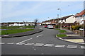
Eastern end of Meadow Lane, Newton
Looking westwards across Woodland Avenue. Porthcawl Primary School is in the background.
Image: © Jaggery
Taken: 29 Mar 2016
0.10 miles
7
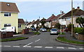
St David's Way, Newton
The eastern end of St David's Way, viewed across Woodland Avenue.
Image: © Jaggery
Taken: 29 Mar 2016
0.10 miles
8

Marlpit Lane, Porthcawl
On the north side of the A4106 Newton Nottage Road.
Image: © Jaggery
Taken: 4 Mar 2017
0.10 miles
9
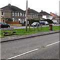
Newton Nottage Road bench, Porthcawl
The bench is opposite allotments on the north side of Newton Nottage Road.
Image: © Jaggery
Taken: 4 Mar 2017
0.11 miles
10
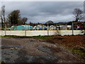
Newton Nottage Road Allotments, Porthcawl
This is the southern edge of Newton Nottage Road Allotments, opposite the A4106 Newton Nottage Road.
The allotments site extends northwards for about 200 metres to Marlpit Lane.
Image: © Jaggery
Taken: 4 Mar 2017
0.12 miles