
IMAGES TAKEN NEAR TO
Marlpit Lane, PORTHCAWL, CF36 5EJ
Introduction
This page details the photographs taken nearby to Marlpit Lane, CF36 5EJ by members of the Geograph project.
The Geograph project started in 2005 with the aim of publishing, organising and preserving representative images for every square kilometre of Great Britain, Ireland and the Isle of Man.

There are currently over 7.5m images from over14,400 individuals and you can help contribute to the project by visiting https://www.geograph.org.uk
Image Map
Images are licensed for reuse under creativecommons.org/licenses/by-sa/2.0
Notes
- Clicking on the map will re-center to the selected point.
- The higher the marker number, the further away the image location is from the centre of the postcode.
Image Listing (39 Images Found)
Images are licensed for reuse under creativecommons.org/licenses/by-sa/2.0
Image
Details
Distance
1
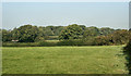
Wooded countryside by Nottage
Trees and farmland immediately to the east of Nottage viewed from a spot on a footpath just off Marlpit Lane. The more distant trees seen here are in an area of ancient woodland bounded by Moor Lane and Pyle Road towards the western edge of the grid square.
Image: © eswales
Taken: 9 Sep 2014
0.11 miles
2
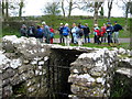
Ffynnon Dewi / St David's Well
Cerddwyr yn cael seibiant gyferbyn a Ffynnon Dewi.
Walkers having a breather opposite St David's Well.
Image: © Alan Richards
Taken: 10 Apr 2005
0.11 miles
3
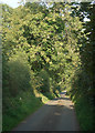
Moor Lane
One of the lanes in the countryside around Porthcawl.
Image: © eswales
Taken: 9 Sep 2014
0.13 miles
4
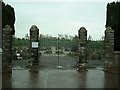
Porthcawl Cemetery
Near the A4229. Dead centre of Porthcawl.
Image: © Chris Shaw
Taken: Unknown
0.14 miles
5
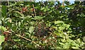
Berries in a hedgerow by St David?s Well, Nottage
Mixed berries in a hedgerow – seen in Image – which lies just to the west of the well’s stone enclosure. They include black elderberries and some unripe, red blackberries. The other red berries in the image appear to be hawthorn.
Image: © eswales
Taken: 9 Sep 2014
0.14 miles
6
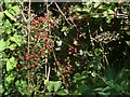
Red berries in a hedgerow near Nottage
Hawthorn berries in a hedgerow next to St David’s Well/Ffynnon Dewi.
Image: © eswales
Taken: 9 Sep 2014
0.14 miles
7
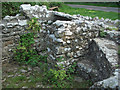
Inside the enclosure at St David?s Well, Nottage
A picture taken inside the enclosure which is seen from the outside in Image The ledges and stone floor visible here are amongst the features of the enclosure mentioned on the British Listed Buildings website (at http://www.britishlistedbuildings.co.uk/wa-19360-st-david-s-well-aka-ffynnon-dewi-porthcaw ). The entrance to the well lies just behind the short wall seen towards the centre of the image. It is shown in Image
Image: © eswales
Taken: 9 Sep 2014
0.14 miles
8
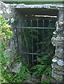
Gated entrance to St David?s Well, Nottage
According to the account of the grade II listed well on the British Listed Buildings website, this entrance ‘leads down 4 stone steps into a curved chamber now dry with culvert in right wall’ (http://www.britishlistedbuildings.co.uk/wa-19360-st-david-s-well-aka-ffynnon-dewi-porthcaw ).
Image: © eswales
Taken: 9 Sep 2014
0.14 miles
9
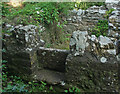
Stile at St David?s Well, Nottage
A stile at the entrance to the enclosure surrounding the well which is seen in Image
Image: © eswales
Taken: 9 Sep 2014
0.14 miles
10
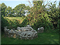
St David?s Well, Nottage
The photograph shows a small stone enclosure which surrounds the well and, within this, stone slabs of the well roof. The stonework seen has undergone restoration. An inscribed stone stands just to the right (north) of the enclosure.
The well is also known as Ffynnon Dewi. It was grade II listed in February 1998, and information about it is to be found on the British Listed Buildings website at http://www.britishlistedbuildings.co.uk/wa-19360-st-david-s-well-aka-ffynnon-dewi-porthcaw .
Image: © eswales
Taken: 9 Sep 2014
0.14 miles