IMAGES TAKEN NEAR TO
Clarke's Row, PORTHCAWL, CF36 3SU

Introduction

This page details the photographs taken nearby to Clarke's Row, CF36 3SU by members of the Geograph project.

The Geograph project started in 2005 with the aim of publishing, organising and preserving representative images for every square kilometre of Great Britain, Ireland and the Isle of Man.

There are currently over 7.5m images from over14,400 individuals and you can help contribute to the project by visiting https://www.geograph.org.uk

Image Map


Images are licensed for reuse under creativecommons.org/licenses/by-sa/2.0
Notes
  • Clicking on the map will re-center to the selected point.
  • The higher the marker number, the further away the image location is from the centre of the postcode.

Image Listing (79 Images Found)

Images are licensed for reuse under creativecommons.org/licenses/by-sa/2.0
  • ...
Image
Details
Distance
1
Rose & Crown
Rose & Crown, Nottage
Image: © Alan Hughes Taken: 20 Dec 2015
0.03 miles
2
Pyle Road, Nottage
Descending from the Heol-y-Capel junction.
Image: © Jaggery Taken: 4 Mar 2017
0.03 miles
3
Rose & Crown in Nottage
Pub on the north side of Heol-y-Capel, opposite the village green.
Image: © Jaggery Taken: 4 Mar 2017
0.04 miles
4
The Rose & Crown, Nottage
View of The Rose & Crown across Nottage green.
Image: © Alan Hughes Taken: 13 Sep 2018
0.04 miles
5
Ordnance Survey Cut Mark
This OS cut mark can be found on the barn north side of Pyle Road. It marks a point 15.746m above mean sea level.
Image: © Adrian Dust Taken: 23 Oct 2017
0.04 miles
6
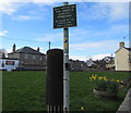
Officialese on a village green dog fouling notice, Nottage
Strictly Forbidden is officialese. It means the same as Forbidden.
Image: © Jaggery Taken: 4 Mar 2017
0.04 miles
7
Tree in the SE corner of the village green, Nottage
On the corner of Ty Canol and Pyle Road.
Image: © Jaggery Taken: 4 Mar 2017
0.05 miles
8
A view towards Nottage
A view from a spot on a public footpath just the other side of a stile from Marlpit Lane. Some buildings at Nottage village are seen in the distance, some 350 or more metres from the camera. The public footpath on which the picture was taken passes across the green field seen in the foreground to the A 4229 road. On the ground, this path is very faint, if not non-existent.
Image: © eswales Taken: 9 Sep 2014
0.06 miles
9
Daffodils in bloom on the village green, Nottage
Viewed on March 4th 2017. The Rose & Crown http://www.geograph.org.uk/photo/5300536 is in the background.
Image: © Jaggery Taken: 4 Mar 2017
0.06 miles
10
Farmers Arms name sign, Nottage, Porthcawl
Faded in March 2017, the sign is on the Ty Canol side of the pub, on the wall here. http://www.geograph.org.uk/photo/5300580
Image: © Jaggery Taken: 4 Mar 2017
0.06 miles
  • ...