1
Heol-y-Capel houses, Nottage
Houses on the north side of the road named Heol-y-Capel, west of the village green.
Image: © Jaggery
Taken: 4 Mar 2017
0.01 miles
2
The Rose & Crown, Nottage
View of The Rose & Crown across Nottage green.
Image: © Alan Hughes
Taken: 13 Sep 2018
0.02 miles
3
Rose & Crown in Nottage
Pub on the north side of Heol-y-Capel, opposite the village green.
Image: © Jaggery
Taken: 4 Mar 2017
0.02 miles
4
Nottage, chapel
General Baptist & Unitarian Chapel, founded 1789.
Image: © Mike Faherty
Taken: 13 Jul 2016
0.02 miles
5
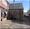
King George V pillarbox on a Nottage corner
The pillarbox is on the right here http://www.geograph.org.uk/photo/5300738 outside 2 Heol-y-Capel which in March 2017 is occupied by ECigg Lifestyle. The presence of a pillarbox suggests that 2 Heol-y-Capel may once have been the village post office.
Image: © Jaggery
Taken: 4 Mar 2017
0.02 miles
6
Nottage Stores
Image: © Mike Faherty
Taken: 13 Jul 2016
0.02 miles
7
East along Old Village Lane, Nottage, Porthcawl
From the corner of West Road and Heol Croes Faen.
Image: © Jaggery
Taken: 4 Mar 2017
0.03 miles
8
Old Village Lane, Nottage, Porthcawl
Looking to the NNE along Old Village Lane from the corner of Heol-y-Capel.
The edge of Curly Tops hair stylist at 1 Heol-y-Capel is on the right. http://www.geograph.org.uk/photo/5300738
Image: © Jaggery
Taken: 4 Mar 2017
0.03 miles
9
Old School Room, Ty Canol, Nottage
The former school room is now the hall of Nottage General Baptist & Unitarian Chapel on the right. http://www.geograph.org.uk/photo/5300624
Image: © Jaggery
Taken: 4 Mar 2017
0.03 miles
10
West along Ty Canol, Nottage
The wall on the right is at the southern edge of the village green.
A sign shows 2½ (miles) to Kenfig (Cynffig in Welsh).
Image: © Jaggery
Taken: 4 Mar 2017
0.03 miles


