IMAGES TAKEN NEAR TO
Ewenny Close, PORTHCAWL, CF36 3HQ
Introduction
This page details the photographs taken nearby to Ewenny Close, CF36 3HQ by members of the Geograph project.
The Geograph project started in 2005 with the aim of publishing, organising and preserving representative images for every square kilometre of Great Britain, Ireland and the Isle of Man.

There are currently over 7.5m images from over14,400 individuals and you can help contribute to the project by visiting https://www.geograph.org.uk
Image Map
Images are licensed for reuse under creativecommons.org/licenses/by-sa/2.0
Notes
- Clicking on the map will re-center to the selected point.
- The higher the marker number, the further away the image location is from the centre of the postcode.
Image Listing (45 Images Found)
Images are licensed for reuse under creativecommons.org/licenses/by-sa/2.0
Image
Details
Distance
1
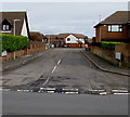
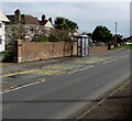
Nottage Meadows, Nottage, Porthcawl
On the northeast side of West Road, Nottage Meadows leads to several residential cul-de-sacs. http://www.geograph.org.uk/photo/5319968
Image: © Jaggery
Taken: 16 Mar 2017
0.04 miles
2
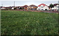
Eastern end of a long field, Nottage, Porthcawl
Viewed from Long Acre Drive looking towards West Road.
Image: © Jaggery
Taken: 16 Mar 2017
0.05 miles
3
Two telecoms cabinets, West Road, Nottage, Porthcawl
BT cabinet on the right, Virgin Media cabinet on the left.
Image: © Jaggery
Taken: 16 Mar 2017
0.05 miles
5

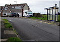
West Road bus stops and shelters, Nottage, Porthcawl
Part of bus route 63B, operated by First Cymru in March 2017.
The stop on the left is for buses to Bridgend via North Cornelly and Pyle.
The stop on the right is for buses to Porthcawl town centre.
Image: © Jaggery
Taken: 16 Mar 2017
0.05 miles
6
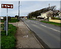
West Road bus stop and shelter near Long Acre Drive, Nottage, Porthcawl
This stop on bus route 63B is for buses from Bridgend to Porthcawl town centre.
In March 2017, the service is operated by First Cymru.
Image: © Jaggery
Taken: 16 Mar 2017
0.06 miles
7
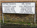
Large bilingual street name sign, Nottage, Porthcawl
The English/Welsh sign is on the right here, http://www.geograph.org.uk/photo/5319963 on the corner of Nottage Meadows and West Road.
Image: © Jaggery
Taken: 16 Mar 2017
0.07 miles
8
Long Acre Drive bus stop and shelter, Nottage, Porthcawl
Near the West Road junction behind the camera.
Image: © Jaggery
Taken: 16 Mar 2017
0.08 miles
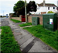
9
Wordless brown direction sign, West Road, Nottage, Porthcawl
The sign shows symbols for a golf course, wildfowl and historic buildings.
Image: © Jaggery
Taken: 16 Mar 2017
0.09 miles
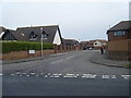
10
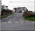
Long Acre Drive, Nottage, Porthcawl
Viewed across West Road.
Image: © Jaggery
Taken: 16 Mar 2017
0.09 miles