IMAGES TAKEN NEAR TO
Locks Common Road, PORTHCAWL, CF36 3DZ
Introduction
This page details the photographs taken nearby to Locks Common Road, CF36 3DZ by members of the Geograph project.
The Geograph project started in 2005 with the aim of publishing, organising and preserving representative images for every square kilometre of Great Britain, Ireland and the Isle of Man.

There are currently over 7.5m images from over14,400 individuals and you can help contribute to the project by visiting https://www.geograph.org.uk
Image Map
Images are licensed for reuse under creativecommons.org/licenses/by-sa/2.0
Notes
- Clicking on the map will re-center to the selected point.
- The higher the marker number, the further away the image location is from the centre of the postcode.
Image Listing (58 Images Found)
Images are licensed for reuse under creativecommons.org/licenses/by-sa/2.0
Image
Details
Distance
1
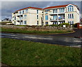
Three-storey houses with a coastal view, Porthcawl
Houses facing the Bristol Channel viewed across Mallard Way from the Wales Coast Path.
Image: © Jaggery
Taken: 27 Feb 2017
0.01 miles
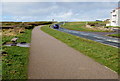
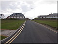
2
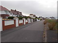
Lock's Common Road - viewed from Mallard Way
Image: © Betty Longbottom
Taken: 26 Jun 2019
0.03 miles
3
Wales Coast Path, Porthcawl
This part of the path is below Mallard Way.
Image: © Jaggery
Taken: 27 Feb 2017
0.03 miles
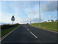
4
Warning sign - Pedestrians crossing, Mallard Way, Porthcawl
The sign above the Wales Coast Path is alongside the English/Welsh SLOW/ARAF
painted on the surface of Mallard Way. The warning sign's text is also in Welsh.
Image: © Jaggery
Taken: 27 Feb 2017
0.04 miles
5
Backless bench alongside the Wales Coast Path, Porthcawl
This part of the path is below Mallard Way.
Image: © Jaggery
Taken: 27 Feb 2017
0.05 miles
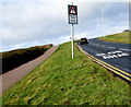
6
Redundant road sign
The roadtrain has been withdrawn and there are no long vehicles entering ahead
Image: © Colin Pyle
Taken: 28 Aug 2010
0.06 miles
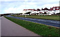
7
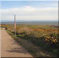
Lock?s Common from the Wales Coast Path
The Porthcawl common beside the Bristol Channel seen in spring with its gorse in flower.
Image: © eswales
Taken: 30 Apr 2015
0.06 miles
8
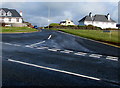
Junction of Mallard Way and Lock's Lane, Porthcawl
Lock's Lane heads away from Mallard Way.
Image: © Jaggery
Taken: 27 Feb 2017
0.08 miles
10
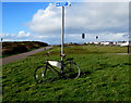
Advertising bicycle supported by a pole near Mallard Way, Porthcawl
Advertising Ristorante Rava http://www.geograph.org.uk/photo/5296888 in Mary Street, Porthcawl, the bicycle rests against
a pole on top of which a blue cycle route sign shows 1 (mile) to Nottage (Notais in Welsh).
Image: © Jaggery
Taken: 27 Feb 2017
0.08 miles