
IMAGES TAKEN NEAR TO
Dunster Road, CARDIFF, CF3 5TP
Introduction
This page details the photographs taken nearby to Dunster Road, CF3 5TP by members of the Geograph project.
The Geograph project started in 2005 with the aim of publishing, organising and preserving representative images for every square kilometre of Great Britain, Ireland and the Isle of Man.

There are currently over 7.5m images from over14,400 individuals and you can help contribute to the project by visiting https://www.geograph.org.uk
Image Map
Images are licensed for reuse under creativecommons.org/licenses/by-sa/2.0
Notes
- Clicking on the map will re-center to the selected point.
- The higher the marker number, the further away the image location is from the centre of the postcode.
Image Listing (100 Images Found)
Images are licensed for reuse under creativecommons.org/licenses/by-sa/2.0
Image
Details
Distance
1
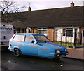
Christmas Day 2012, about noon, Robin
A blue Robin on Dunster Road.
Image: © chris whitehouse
Taken: 25 Dec 2012
0.02 miles
2
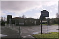
Primary School
St. Mellons Church in Wales Primary School, Dunster Road
Image: © chris whitehouse
Taken: 25 Dec 2012
0.03 miles
3
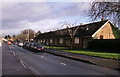
Terraced bungalows
Small bungalows on Dunster Road
Image: © chris whitehouse
Taken: 25 Dec 2012
0.04 miles
4
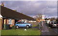
Terraced bungalows on west side
Similar bungalows to Image but on the west side of Dunster Road.
Image: © chris whitehouse
Taken: 25 Dec 2012
0.04 miles
5
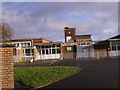
St.Mellons Church in Wales School
Another school on Dunster Road, cannot read the green sign by the door!
Image: © chris whitehouse
Taken: 25 Dec 2012
0.05 miles
6

North along Bridgwater Road, Llanrumney, Cardiff
Along Bridgwater Road from Minehead Road towards Instow Place past the right turn into Axbridge Crescent.
Image: © Jaggery
Taken: 4 Jul 2017
0.06 miles
7
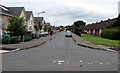
Dunster Road, Llanrumney, Cardiff
North along Dunster Road from Minehead Road.
Image: © Jaggery
Taken: 4 Jul 2017
0.07 miles
8
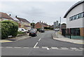
Blackmoor Place, Llanrumney, Cardiff
From Countisbury Avenue along Blackmoor Place towards Dulverton Avenue and Dunster Road.
Llanrumney Library and Community Hub http://www.geograph.org.uk/photo/5450959 is on the right.
Image: © Jaggery
Taken: 4 Jul 2017
0.07 miles
9
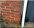
Ordnance Survey Cut Mark
This OS cut mark can be found on No100 Countisbury Avenue. It marks a point 47.052m above mean sea level.
Image: © Adrian Dust
Taken: 29 Dec 2021
0.08 miles
10

West side of Dunster Road, Llanrumney, Cardiff
From Minehead Road.
Image: © Jaggery
Taken: 4 Jul 2017
0.08 miles