1
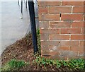
Ordnance Survey Cut Mark
This OS cut mark can be found on No58 Burnham Avenue. It marks a point 43.836m above mean sea level.
Image: © Adrian Dust
Taken: 29 Dec 2021
0.07 miles
2
Ilchester Road, Llanrumney, Cardiff
West along Ilchester Road from Countisbury Avenue.
Image: © Jaggery
Taken: 4 Jul 2017
0.17 miles
3
West along Bampton Road, Llanrumney, Cardiff
From Countisbury Avenue along Bampton Road towards Burnham Avenue.
Image: © Jaggery
Taken: 4 Jul 2017
0.18 miles
4
Ordnance Survey Cut Mark
This OS cut mark can be found on No59 Thackeray Crescent. It marks a point 18.986m above mean sea level.
Image: © Adrian Dust
Taken: 29 Dec 2021
0.20 miles
5
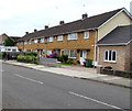
Row of houses, Countisbury Avenue, Llanrumney, Cardiff
South of the Bampton Road junction. http://www.geograph.org.uk/photo/5450970
Image: © Jaggery
Taken: 4 Jul 2017
0.21 miles
6
Christmas Day about noon, Area Housing Office
Cardiff Housing (Tai Caerdydd) Area Housing Office on Countisbury Avenue.
Image: © chris whitehouse
Taken: 25 Dec 2012
0.22 miles
7
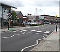
Zebra crossing to Llanrumney Library and Community Hub, Cardiff
The crossing on a hump across Countisbury Avenue leads to Llanrumney Library and Community Hub. http://www.geograph.org.uk/photo/5450959
Image: © Jaggery
Taken: 4 Jul 2017
0.22 miles
8
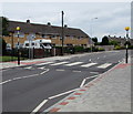
Zebra crossing on a hump, Countisbury Avenue, Llanrumney, Cardiff
Recently installed zebra crossing viewed in early July 2017.
An April 2016 Google Earth Street View shows humps but no crossing here.
Image: © Jaggery
Taken: 4 Jul 2017
0.22 miles
9
Ordnance Survey Cut Mark
This OS cut mark can be found on No100 Countisbury Avenue. It marks a point 47.052m above mean sea level.
Image: © Adrian Dust
Taken: 29 Dec 2021
0.23 miles
10
Llanrumney Library and Community Hub, Cardiff
On the corner of Countisbury Avenue and Blackmoor Place in the Llanrumney area of Cardiff.
The Welsh for Library and Community Hub is on the left side of the building.
The English version is on the right.
Image: © Jaggery
Taken: 4 Jul 2017
0.23 miles


