1
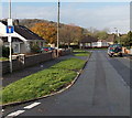
Hafod Las bungalows, Pencoed
Bungalows on the north side of Hafod Las, viewed from near the edge of Ton Teg. http://www.geograph.org.uk/photo/2267847
Image: © Jaggery
Taken: 12 Feb 2011
0.10 miles
2
Hafod Las, Pencoed
On the west side of Coychurch Road.
Image: © Jaggery
Taken: 9 Nov 2014
0.13 miles
3
Waste ground on the east side of Goat Road, Pencoed
The fenced-off site, about 120 metres by 70 metres, is between Goat Road and railway lines.
It looks likes the site of a demolished factory.
Image: © Jaggery
Taken: 9 Nov 2014
0.13 miles
4
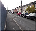
Goat Road, Pencoed
Houses on the west side of Goat Road face the perimeter fence enclosing waste ground. http://www.geograph.org.uk/photo/4242350
Image: © Jaggery
Taken: 9 Nov 2014
0.13 miles
5
Wilsons electricity substation, Pencoed
The Western Power Distribution electricity substation is set back 30 metres
from the west side of Coychurch Road. Its identifier is WILSONS S/S 561240.
Image: © Jaggery
Taken: 9 Nov 2014
0.13 miles
6
Salem Chapel and Vestry, Pencoed
The chapel http://www.geograph.org.uk/photo/2267937 and vestry http://www.geograph.org.uk/photo/2267954 are on Coychurch Road.
Image: © Jaggery
Taken: 12 Feb 2011
0.15 miles
7
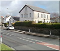
Salem Chapel vestry, Pencoed
On Coychurch Road, located next to the Grade II listed chapel. http://www.geograph.org.uk/photo/2267937
A vestry is used for keeping vestments, vessels, records, etc, and as a robing-room. This vestry is also used for various community functions and is the meeting place for the local girl guides.
Image: © Jaggery
Taken: 12 Feb 2011
0.15 miles
8
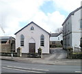
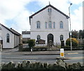
Salem Chapel, Pencoed
Grade II listed Welsh Calvinist Methodist chapel, Coychurch Road. It was opened in 1888 on the site of two previous chapels. The original chapel was set up in 1775, the first Methodist chapel in Glamorgan. In 1830 a larger chapel was built on the same site, with a seating capacity said to be 500.
On the left is the chapel vestry. http://www.geograph.org.uk/photo/2267954
Image: © Jaggery
Taken: 12 Feb 2011
0.15 miles
9
Queen Elizabeth II pillarbox, Coychurch Road, Pencoed
Located on the right here. http://www.geograph.org.uk/photo/4520965
Image: © Jaggery
Taken: 9 Nov 2014
0.15 miles
10
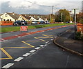
Coychurch Road closed ahead, Pencoed
For the Remembrance Sunday Parade on November 9th 2014. http://www.geograph.org.uk/photo/4520913
Image: © Jaggery
Taken: 9 Nov 2014
0.15 miles


