1
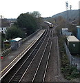
Platform 1, Pencoed railway station
Viewed from the station footbridge. Platform 1 is for westbound trains. Facing it is not platform 2, but the premises of builders' merchants http://www.geograph.org.uk/photo/2270016 Platform 2 is about 100 metres behind the camera, on the other side of a level crossing. http://www.geograph.org.uk/photo/2269966
Image: © Jaggery
Taken: 12 Feb 2011
0.02 miles
2
First Great Western train approaches Pencoed railway station from Bridgend
Approaching is a First Great Western express to London Paddington. It does not stop at Pencoed.
Platform 1 on the left is for trains to Bridgend, Port Talbot Parkway, Neath, Swansea and points further west.
Platform 2 for trains towards Cardiff and Newport is behind the camera.
Image: © Jaggery
Taken: 9 Nov 2014
0.03 miles
3
Railway towards Bridgend from Pencoed
Viewed from Pencoed railway station platform 1.
Image: © Jaggery
Taken: 9 Nov 2014
0.03 miles
4
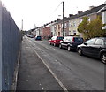
Goat Road, Pencoed
Houses on the west side of Goat Road face the perimeter fence enclosing waste ground. http://www.geograph.org.uk/photo/4242350
Image: © Jaggery
Taken: 9 Nov 2014
0.04 miles
5
Electricity cabinet on platform 1, Pencoed railway station
The cabinet supplies power for the platform lights.
Image: © Jaggery
Taken: 9 Nov 2014
0.04 miles
6
Platform 1, Pencoed railway station
Viewed from the station footbridge. Platform 1 is for westbound trains.
Next station ahead is Bridgend on the route to Swansea.
Opposite platform 1 are the premises of J.Davey builders merchants & DIY centre. http://www.geograph.org.uk/photo/4787875
Platform 2 is about 100 metres behind the camera, on the other side of a level crossing. http://www.geograph.org.uk/photo/4787870
Image: © Jaggery
Taken: 9 Nov 2014
0.04 miles
7
Waste ground on the east side of Goat Road, Pencoed
The fenced-off site, about 120 metres by 70 metres, is between Goat Road and railway lines.
It looks likes the site of a demolished factory.
Image: © Jaggery
Taken: 9 Nov 2014
0.04 miles
8
Builders' merchants premises opposite Pencoed railway station
Viewed from the station footbridge. The premises of J.Davey, builders' merchants, are opposite platform 1 (for westbound trains). Platform 2 is about 100 metres behind the camera, on the other side of a level crossing. http://www.geograph.org.uk/photo/2269966
Image: © Jaggery
Taken: 12 Feb 2011
0.05 miles
9
Hendre Road buildings viewed from Pencoed railway station footbridge
Viewed across the level crossing http://www.geograph.org.uk/photo/2269966 through the middle of the station. The premises on the left with the white-on-blue sign is The Cutting Crew, unisex hair studio. On the right is the edge of the Britannia Inn.
Image: © Jaggery
Taken: 12 Feb 2011
0.05 miles
10
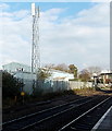
Communications mast at the edge of Pencoed railway station
Viewed from platform 1.
Image: © Jaggery
Taken: 9 Nov 2014
0.06 miles


