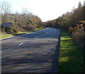
IMAGES TAKEN NEAR TO
Minffrwd Road, BRIDGEND, CF35 6SD

Introduction

This page details the photographs taken nearby to Minffrwd Road, CF35 6SD by members of the Geograph project.

The Geograph project started in 2005 with the aim of publishing, organising and preserving representative images for every square kilometre of Great Britain, Ireland and the Isle of Man.

There are currently over 7.5m images from over14,400 individuals and you can help contribute to the project by visiting https://www.geograph.org.uk

Image Map


Images are licensed for reuse under creativecommons.org/licenses/by-sa/2.0
Notes
  • Clicking on the map will re-center to the selected point.
  • The higher the marker number, the further away the image location is from the centre of the postcode.

Image Listing (35 Images Found)

Images are licensed for reuse under creativecommons.org/licenses/by-sa/2.0
  • ...
Image
Details
Distance
1
Minffrwd Road north of Pentwyn Road in Pencoed
Minffrwd Road climbs north away from the Pentwyn Road crossroads.
Image: © Jaggery Taken: 14 Nov 2014
0.03 miles
2
S & T Tyre Services in Pencoed
Garage at 88 Penprysg Road.
Image: © Jaggery Taken: 14 Nov 2014
0.06 miles
3
Cars, church and garage, Penprysg Road, Pencoed
The east side of Penprysg Road, viewed from the corner of Penylan Road. Zion Pentecostal Church Assemblies of God http://www.geograph.org.uk/photo/4248250 is next door to S & T Tyre Services. http://www.geograph.org.uk/photo/4248378
Image: © Jaggery Taken: 14 Nov 2014
0.06 miles
4
Penprysg Village View
Featuring S & T Tyre Services premises and the Zion Pentecostal Church.
Image: © Ian Paterson Taken: 2 Jun 2008
0.06 miles
5
Zion, Pencoed
On the east side of Penprysg Road, facing the Penylan Road junction. In November 2014, the nameboard shows Zion Pentecostal Church Assemblies of God.
Image: © Jaggery Taken: 14 Nov 2014
0.07 miles
6
Pentwyn Road, Pencoed
Pentwyn Road east of the Minffrwd Road crossroads.
Image: © Jaggery Taken: 14 Nov 2014
0.08 miles
7
B4280, Pencoed
Near the northern edge of Pencoed, the B4280 heads away from the Penprysg Road junction. Destinations ahead shown on the sign are Graig-lâs, Rhiwceiliog, Brynna and Llanharan.
Image: © Jaggery Taken: 14 Nov 2014
0.10 miles
8
Islawen Meadows, Pencoed
Looking across Penprysg Road to the NE end of a long dead-end road named Islawen Meadows, on the south side of Islawen Farm.
Image: © Jaggery Taken: 14 Nov 2014
0.10 miles
9
Pencoed Travel coaches in Pencoed
Two coaches are in a small parking area between Penprysg Road and Islawen Meadows.
Image: © Jaggery Taken: 14 Nov 2014
0.11 miles
10
Vale Reach, Pencoed
Cul-de-sac on the SE side of Penprysg Road.
Image: © Jaggery Taken: 14 Nov 2014
0.11 miles
  • ...