1
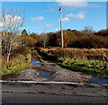
Maes-y-gwaelod near Heol-y-cyw
Out of shot on the right, a name sign on the corner of the B4280 shows Maes-y-gwaelod.
Image: © Jaggery
Taken: 14 Nov 2014
0.06 miles
2
Illegal activity notice on an entrance gate to Hirwaun Common near Heol-y-cyw
Located here. http://www.geograph.org.uk/photo/4249559 The notice tells would-be offroaders that riding or driving off road on common land is in contravention of Section 34 of the Traffic Act 1988 and Section 59 of the Police Reform Act. Offending vehicles may be seized by the police. The right side of the notice lists places where off road riding is legal.
Image: © Jaggery
Taken: 14 Nov 2014
0.10 miles
3
Gate to Hirwaun Common near Heol-y-cyw
Viewed across the B4280, the road from Heol-y-cyw to Pencoed.
Image: © Jaggery
Taken: 14 Nov 2014
0.10 miles
4
Two triangular road signs SE of Heol-y-cyw
Alongside the B4280 on the approach to a minor road junction
at a left-hand bend, and a narrowing of the roadway.
Image: © Jaggery
Taken: 14 Nov 2014
0.11 miles
5
Public footpath sign at the edge of the B4280 NW of Pencoed
The track towards a stream, Nant Crymlyn, doesn't appear to be a well-trodden route.
Image: © Jaggery
Taken: 14 Nov 2014
0.12 miles
6
Nant Crymlyn SE of Heol-y-cyw
Viewed from this http://www.geograph.org.uk/photo/4249592 bridge carrying the B4280 over the stream.
Image: © Jaggery
Taken: 14 Nov 2014
0.12 miles
7
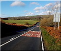
SLOW signs on the uphill side of the B4280 near Pencoed
Drivers are told to slow down on the approach to a concealed entrance. ARAF is Welsh for SLOW.
Image: © Jaggery
Taken: 14 Nov 2014
0.14 miles
8
Bridge over the Nant Crymlyn, Bryngarn
Image: © Mick Lobb
Taken: 24 Oct 2008
0.14 miles
9
Uphill along the B4280 towards Pencoed
The road from Heol-y-cyw heads SE towards Pencoed.
A sign on the left http://www.geograph.org.uk/photo/4249539 points towards a public footpath.
Image: © Jaggery
Taken: 14 Nov 2014
0.14 miles
10
Road bridge over a stream SE of Heol-y-cyw
The B4280 crosses a bridge over Nant Crymlyn. http://www.geograph.org.uk/photo/4249590
Image: © Jaggery
Taken: 14 Nov 2014
0.15 miles


