1
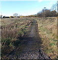
Brynteg houses, Heol-y-cyw
Set back 60 metres from the north side of the B4280.
Image: © Jaggery
Taken: 14 Nov 2014
0.02 miles
2
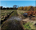
Access road to Brynteg houses, Heol-y-cyw
From the north side of the B4280.
Image: © Jaggery
Taken: 14 Nov 2014
0.03 miles
3
Drainage channel near Brynteg, Heol-y-cyw
Between the B4280 on the left and Brynteg. http://www.geograph.org.uk/photo/4396369
Image: © Jaggery
Taken: 14 Nov 2014
0.04 miles
4
Mesh covered notice, Brynteg, Heol-y-cyw
Protected by metal mesh, the notice shows
TIPPING OF RUBBISH AND LIGHTING OF FIRES IS STRICTLY PROHIBITED.
The phrase Strictly Prohibited is officialese. It means the same as Prohibited.
Image: © Jaggery
Taken: 14 Nov 2014
0.04 miles
5
Path bypassing a bend in the B4280, Heol-y-cyw
Giving walkers a safe alternative to the pavementless B4280 on a bend.
Image: © Jaggery
Taken: 14 Nov 2014
0.05 miles
6
B4280 bridge over a brook near Brynteg, Heol-y-cyw
The bridge carries the road over a brook, a small tributary of the stream Nant Crymlyn.
Image: © Jaggery
Taken: 14 Nov 2014
0.05 miles
7
Ordnance Survey Cut Mark
This OS cut mark can be found on the north parapet of the bridge. It marks a point 69.745m above mean sea level.
Image: © Adrian Dust
Taken: 28 Apr 2018
0.05 miles
8
Kissing gate to open access (common) land, Heol-y-cyw
South of Brynteg.
Image: © Jaggery
Taken: 14 Nov 2014
0.05 miles
9
Pathside bench, Heol-y-cyw
The path is on the north side of the B4280.
Image: © Jaggery
Taken: 14 Nov 2014
0.06 miles
10
Holy Cow
Batman! Well, that's what it looked like to me as I passed by.
Discovered that it's pronounced 'Heel a coo'.
Now I'm thinking of shoes for cattle instead!
Image: © Ian Paterson
Taken: 2 Jun 2008
0.07 miles


