1
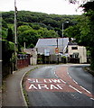
Oak Ridge houses, Blackmill
Houses on the east side of the A4061 Oak Ridge.
Image: © Jaggery
Taken: 25 Aug 2018
0.04 miles
2
SLOW/ARAF on Oak Ridge, Blackmill
English/Welsh text painted on the A4061 Oak Ridge on the approach to a bend.
Image: © Jaggery
Taken: 25 Aug 2018
0.04 miles
3
Warning sign - Pant cudd/Hidden dip, Blackmill
The Welsh/English sign faces southbound traffic on the A4061.
Image: © Jaggery
Taken: 25 Aug 2018
0.06 miles
4
A4061 and A4093 directions sign, Blackmill
Facing southbound traffic on the A4061 on the approach to the A4093 Graig Terrace junction.
Pen-y-bont is Welsh for Bridgend.
Image: © Jaggery
Taken: 25 Aug 2018
0.06 miles
5
Chapel building on the corner
This chapel - complete with graveyard, is at the junction of the A4093 with the A4061.
Image: © Ruth Sharville
Taken: 23 Jun 2007
0.06 miles
6
Post Office flanked by pubs
The pub on the left is the Fox and Hounds, and the blue building is the Ogmore Junction.
Image: © Ruth Sharville
Taken: 23 Jun 2007
0.08 miles
7
Three years on the Paran Chapel tablet, Blackmill
The Welsh text on the tablet on this https://www.geograph.org.uk/photo/5884462 chapel records that it was built in 1819, extended in 1858 and renovated in 1898.
Image: © Jaggery
Taken: 25 Aug 2018
0.08 miles
8
Paran Chapel, Blackmill
Paran Chapel is an independent Baptist Church on the corner of the A4061 and A4093. A stone plaque https://www.geograph.org.uk/photo/5884477 on the building in Welsh records that the chapel was built in 1819, extended in 1858 and renovated in 1898. The building was Grade II listed in 1997.
Image: © Jaggery
Taken: 25 Aug 2018
0.08 miles
9
Combined speed camera and speed limit sign, Oak Ridge, Blackmill
Facing traffic on the A4061 Oak Ridge on the descent to the centre of Blackmill.
Image: © Jaggery
Taken: 25 Aug 2018
0.09 miles
10
A glimpse of the River Ogmore just north of Blackmill
A very short stretch of the river viewed from a crossing on the Ogmore Valley cycle path. Here, north of Blackmill, the river is also known as the Ogwr Fawr.
Image: © eswales
Taken: 25 Oct 2013
0.09 miles


