1
Felindre Avenue, Pencoed
Looking north across Felindre Road.
Image: © Jaggery
Taken: 9 Nov 2014
0.08 miles
2
Pencoed Police Station
Located on Heol-y-groes, facing the T-junction with Ton-y-groes. The station is part of South Wales Police, one of the four police forces in Wales.
Image: © Jaggery
Taken: 12 Feb 2011
0.11 miles
3
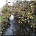
Ewenny River north of Felindre Road, Pencoed
The Ewenny flows towards the camera on Felindre Road bridge. The river is a tributary of the River Ogmore, which it joins c2 km from the sea, near Ogmore Castle.
Image: © Jaggery
Taken: 9 Nov 2014
0.11 miles
4
Cross Meadow, Pencoed
The street name sign shows Cross Meadow below the Welsh Ton y Groes.
Viewed from Cross Road (Heol y Groes).
Image: © Jaggery
Taken: 9 Nov 2014
0.12 miles
5
Pencoed Police Station
Located on the north side of Cross Road (Heol-y-Groes in Welsh), opposite
the Cross Meadow (Ton-y-groes) junction, the station is part of the South Wales Police force.
Image: © Jaggery
Taken: 9 Nov 2014
0.12 miles
6
End of the dual carriageway section of the A473, Pencoed
The grass strip separating the carriageways ends on the right.
The triangular sign with two opposing black arrows draws attention to the change.
Image: © Jaggery
Taken: 9 Nov 2014
0.12 miles
7
Pencoed R.A.O.B social club
The club is set back from Penybont Road and Heol-y-groes, behind the community hall. http://www.geograph.org.uk/photo/2268407
R.A.O.B (the Royal Antediluvian Order of Buffaloes) is a philanthropic and charitable body, whose lodges and provinces undertake whatever activity they consider appropriate for the needs of their local community.
Image: © Jaggery
Taken: 12 Feb 2011
0.13 miles
8
Felindre Road
Image: © kenneth rees
Taken: 26 Feb 2007
0.13 miles
9
Pavement alongside the A473, Pencoed
Some similar bypass or quasi-bypass A roads ban pedestrians,
or at best have only grass verges to walk on, so this pavement was a welcome feature.
Image: © Jaggery
Taken: 9 Nov 2014
0.13 miles
10
Sunday rugby match in Pencoed
Game in progress in November 2014 on Pencoed RFC's pitch on the south side of Felindre Road.
Image: © Jaggery
Taken: 9 Nov 2014
0.14 miles


