IMAGES TAKEN NEAR TO
Waldsassen Road, BRIDGEND, CF35 5LW

Introduction

This page details the photographs taken nearby to Waldsassen Road, CF35 5LW by members of the Geograph project.

The Geograph project started in 2005 with the aim of publishing, organising and preserving representative images for every square kilometre of Great Britain, Ireland and the Isle of Man.

There are currently over 7.5m images from over14,400 individuals and you can help contribute to the project by visiting https://www.geograph.org.uk

Image Map


Images are licensed for reuse under creativecommons.org/licenses/by-sa/2.0
Notes
  • Clicking on the map will re-center to the selected point.
  • The higher the marker number, the further away the image location is from the centre of the postcode.

Image Listing (53 Images Found)

Images are licensed for reuse under creativecommons.org/licenses/by-sa/2.0
  • ...
Image
Details
Distance
1
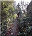
Public footpath SE of Coychurch Road, Pencoed
Accessed from Coychurch Road via this http://www.geograph.org.uk/photo/4387779 kissing gate.
Image: © Jaggery Taken: 9 Nov 2014
0.03 miles
2
Bridgend District : The M4 Motorway
Heading through the Bridgend area of Wales westbound along the M4 Motorway.
Image: © Lewis Clarke Taken: 10 Apr 2014
0.06 miles
3
Junction 35 M4 eastbound
Image: © John Firth Taken: 5 Sep 2012
0.06 miles
4
Meadow Road, Pencoed
Looking NE from the Pencoed Way end.
Image: © Jaggery Taken: 9 Nov 2014
0.07 miles
5
St Mary Close, Pencoed
Viewed across Pencoed Way.
Image: © Jaggery Taken: 9 Nov 2014
0.07 miles
6
Southern arm of Heol Maes-yr-Haf, Pencoed
Viewed from the main course of Heol Maes-yr-Haf looking towards the embankment carrying the M4 motorway near junction 35.
Image: © Jaggery Taken: 9 Nov 2014
0.08 miles
7
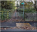
Kissing gate to a public footpath in Pencoed
On the east side of Coychurch Road, a few metres south of this http://www.geograph.org.uk/photo/2266961 motorway overbridge.
Image: © Jaggery Taken: 9 Nov 2014
0.09 miles
8
Ordnance Survey Cut Mark
This OS cut mark can be found on Ivy Cottage. It marks a point 26.137m above mean sea level.
Image: © Adrian Dust Taken: 20 May 2018
0.09 miles
9
Housing variety, Coychurch Road, Pencoed
Houses on the east side of Coychurch Road, on the south side of the M4.
Image: © Jaggery Taken: 12 Feb 2011
0.10 miles
10
Coychurch Road passes beneath M4 motorway, Pencoed
Is this a long bridge or a short tunnel? The structure, extending for 60 metres above the course of Coychurch Road, carries the M4 motorway. The location is about 500 metres WNW of M4 junction 35.
Image: © Jaggery Taken: 12 Feb 2011
0.10 miles
  • ...