1
St Mary Close, Pencoed
Viewed across Pencoed Way.
Image: © Jaggery
Taken: 9 Nov 2014
0.03 miles
2
Meadow Road, Pencoed
Looking NE from the Pencoed Way end.
Image: © Jaggery
Taken: 9 Nov 2014
0.04 miles
3
Housing variety, Coychurch Road, Pencoed
Houses on the east side of Coychurch Road, on the south side of the M4.
Image: © Jaggery
Taken: 12 Feb 2011
0.05 miles
4
Private car park, Bocam Park, Pencoed
For occupiers of Bocam Park only.
Image: © Jaggery
Taken: 9 Nov 2014
0.06 miles
5
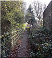
Public footpath SE of Coychurch Road, Pencoed
Accessed from Coychurch Road via this http://www.geograph.org.uk/photo/4387779 kissing gate.
Image: © Jaggery
Taken: 9 Nov 2014
0.08 miles
6
Coychurch Road, Pencoed
SW of the M4 motorway overbridge. http://www.geograph.org.uk/photo/4387777
The red postbox in the wall is from the reign of King George VI. http://www.geograph.org.uk/photo/4387785
Image: © Jaggery
Taken: 9 Nov 2014
0.08 miles
7
Coychurch Road passes beneath M4 motorway, Pencoed
Is this a long bridge or a short tunnel? The structure, extending for 60 metres above the course of Coychurch Road, carries the M4 motorway. The location is about 500 metres WNW of M4 junction 35.
Image: © Jaggery
Taken: 12 Feb 2011
0.08 miles
8
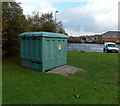
Bocam Park Housing electricity substation, Pencoed
The identifier on the Western Power Distribution electricity substation on the east side of Pencoed Way is BOCAM PARK HOUSING S/S 564346.
Image: © Jaggery
Taken: 9 Nov 2014
0.08 miles
9
Ordnance Survey Cut Mark
This OS cut mark can be found on Ivy Cottage. It marks a point 26.137m above mean sea level.
Image: © Adrian Dust
Taken: 20 May 2018
0.08 miles
10
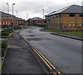
Main road through Bocam Park, Pencoed
Looking east from the Pencoed Way end. Bocam Park is a business park near M4 motorway junction 35.
Image: © Jaggery
Taken: 9 Nov 2014
0.09 miles


